
File:Wick Town Hall (geograph 6897593) (cropped2).jpg
Size of this preview: 252 × 600 pixels. Other resolutions: 101 × 240 pixels | 201 × 480 pixels | 926 × 2,204 pixels.
Original file (926 × 2,204 pixels, file size: 409 KB, MIME type: image/jpeg)
| This is a file from the Wikimedia Commons. Information from its description page there is shown below. Commons is a freely licensed media file repository. You can help. |
Summary
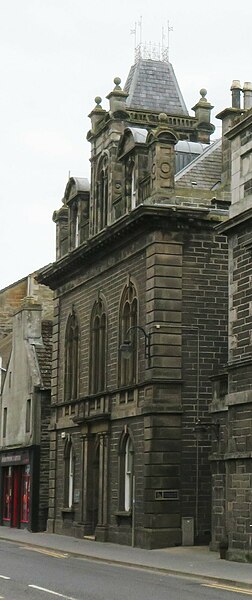
| Description | Wick Sheriff Court |
| Date | |
| Source |
This file was derived from: Wick Town Hall (geograph 6897593).jpg |
| Author | Gordon Hatton |
| Permission (Reusing this file) |
This file is licensed under the Creative Commons Attribution-Share Alike 2.0 Generic license. Attribution: Gordon Hatton
|
| Attribution (required by the license) | Gordon Hatton / Wick Town Hall / |
| Camera location | | View this and other nearby images on: OpenStreetMap |
|---|
| Object location | | View this and other nearby images on: OpenStreetMap |
|---|
| This is a retouched picture, which means that it has been digitally altered from its original version. Modifications: cropped. The original can be viewed here: Wick Town Hall (geograph 6897593).jpg:
|
File history
Click on a date/time to view the file as it appeared at that time.
| Date/Time | Thumbnail | Dimensions | User | Comment | |
|---|---|---|---|---|---|
| current | 19:31, 16 December 2023 |  | 926 × 2,204 (409 KB) | Bjh21 | Re-cropped from higher-resolution version: File:Wick Town Hall (geograph 6897593).jpg cropped 81 % horizontally, 34 % vertically using CropTool with lossless mode. |
| 15:59, 25 December 2022 |  | 155 × 369 (27 KB) | Dormskirk | {{Information |Description =Wick Sheriff Court |Source =*File:Wick Town Hall (geograph 6897593).jpg |Author =Gordon Hatton |Date =12 June 2021 |Permission ={{PD-user|Gordon Hatton}} |other_versions = }} {{RetouchedPicture|cropped|editor=Dormskirk|orig=Wick Town Hall (geograph 6897593).jpg}} Category:Wick |
.jpg)
File usage
The following pages on the English Wikipedia use this file (pages on other projects are not listed):
Global file usage
The following other wikis use this file:
- Usage on www.wikidata.org