
File:West Philippine Sea.svg
Size of this PNG preview of this SVG file: 384 × 599 pixels. Other resolutions: 154 × 240 pixels | 307 × 480 pixels | 492 × 768 pixels | 656 × 1,024 pixels | 1,313 × 2,048 pixels | 507 × 791 pixels.
Original file (SVG file, nominally 507 × 791 pixels, file size: 766 KB)
| This is a file from the Wikimedia Commons. Information from its description page there is shown below. Commons is a freely licensed media file repository. You can help. |
Summary
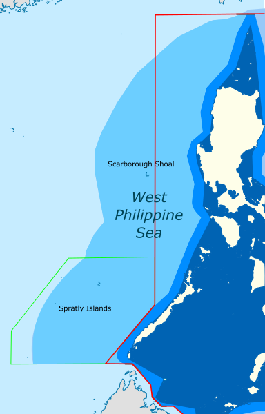
| Description | Map showing the area in the South China Sea which roughly correspond to the "West Philippine Sea" |
| Date | (UTC) |
| Source |
This file was derived from: |
| Author |
|


| This is a retouched picture, which means that it has been digitally altered from its original version. The original can be viewed here: Ph Territorial Map.png:
|
Licensing
This file is licensed under the Creative Commons Attribution-Share Alike 3.0 Unported license.
- You are free:
- to share – to copy, distribute and transmit the work
- to remix – to adapt the work
- Under the following conditions:
- attribution – You must give appropriate credit, provide a link to the license, and indicate if changes were made. You may do so in any reasonable manner, but not in any way that suggests the licensor endorses you or your use.
- share alike – If you remix, transform, or build upon the material, you must distribute your contributions under the same or compatible license as the original.
Original upload log
This image is a derivative work of the following images:
- File:South China Sea location map.svg licensed with Cc-by-sa-3.0, Cc-by-sa-3.0-de
- 2011-08-17T18:56:31Z NordNordWest 1134x1229 (631729 Bytes) == {{int:filedesc}} == {{Information |Description= {{de|Positionskarte des [[:de:Südchinesisches Meer|Südchinesischen Meers]]}} Quadratische Plattkarte, N-S-Streckung 102 %. Geographische Begrenzung der Karte: * N: 25.5° N
- File:Ph Territorial Map.png licensed with Cc-by-2.5, GFDL
- 2015-07-19T05:58:17Z Schadow1 1827x1877 (627018 Bytes) Extending EEZ boundaries to include Benham Rise Extended EEZ and Philippines-Indonesia EEZ Delimitation Agreement
- 2012-05-08T11:33:56Z Sky Harbor 1827x1790 (547714 Bytes) Reverted to version as of 16:54, 28 August 2009. The name "West Philippine Sea" is a neologism and is not neutral.
- 2012-05-04T08:13:30Z Jeromesandilanico 612x600 (131658 Bytes) Change of name as West Philippine Sea as used to describe the Philippines official claim as used by the Philippine Government and Media.
- 2009-08-28T16:54:58Z Mormegil 1827x1790 (547714 Bytes) {{Information |Description= {{en|Territorial map of the [[Philippines]], showing internal waters, territorial sea, international treaty limits and exclusive economic zone.}} |Source=[[:en:File:Ph Territorial Map.png|English W
Uploaded with derivativeFX
File history
Click on a date/time to view the file as it appeared at that time.
| Date/Time | Thumbnail | Dimensions | User | Comment | |
|---|---|---|---|---|---|
| current | 16:05, 19 April 2024 | 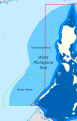 | 507 × 791 (766 KB) | Hariboneagle927 | International Treaty Limits + KIG border often included in NAMRIA maps |
| 00:29, 10 April 2021 |  | 507 × 791 (765 KB) | Hariboneagle927 | adjust color | |
| 00:21, 10 April 2021 | 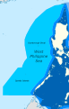 | 507 × 791 (761 KB) | Hariboneagle927 | == {{int:filedesc}} == {{Information |Description= |Source={{Derived from|South China Sea location map.svg|Ph Territorial Map.png|display=50}} |Date=2021-04-10 00:21 (UTC) |Author=* File:South China Sea location map.svg: NordNordWest * File:Ph Territorial Map.png: '''PLEASE COMPLETE AUTHOR INFORMATION''' * derivative work: [[User:{{subst:REVISIONUSER}}|{{subst:REVISIONUSER}}]] |Permission= |other... |
File usage
The following pages on the English Wikipedia use this file (pages on other projects are not listed):
Global file usage
The following other wikis use this file:
- Usage on bcl.wikipedia.org
- Usage on id.wikipedia.org
- Usage on pt.wikipedia.org
- Usage on tl.wikipedia.org
- Usage on www.wikidata.org