
File:United Kingdom Portugal Locator.png
Size of this preview: 800 × 583 pixels. Other resolutions: 320 × 233 pixels | 640 × 467 pixels | 1,024 × 747 pixels | 1,280 × 934 pixels | 1,788 × 1,304 pixels.
Original file (1,788 × 1,304 pixels, file size: 123 KB, MIME type: image/png)
| This is a file from the Wikimedia Commons. Information from its description page there is shown below. Commons is a freely licensed media file repository. You can help. |
Summary
| Description |
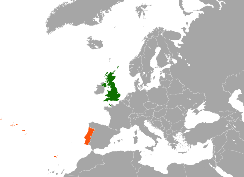
English: Map of Europe indicating the United Kingdom and Portugal. For use in British-Portuguese relations and similar articles. |
| Date | |
| Source |
|
| Author | en:User:Dancingwombatsrule |
Licensing
| This work has been released into the public domain by its author, Dancingwombatsrule at English Wikipedia. This applies worldwide. In some countries this may not be legally possible; if so: Dancingwombatsrule grants anyone the right to use this work for any purpose, without any conditions, unless such conditions are required by law. |
Original upload log
The original description page was here. All following user names refer to en.wikipedia.
| Upload date | User | Bytes | Dimensions | Comment |
|---|---|---|---|---|
| 2007-12-17 12:49:42 | Dancingwombatsrule | 64791 | 1217×974 | == Summary == '''Description:''' Map of [[Europe]] indicating the [[United Kingdom]] and [[Portugal]]. For use in [[British-Portuguese relations]] and similar articles. '''Source:''' Own work based on [[:Image:United Kingdom Greece Locator.png]] '''Cr |
| 2007-07-19 10:59:30 | Dancingwombatsrule | 47438 | 1357×628 | Description: Map of the world indicating the United Kingdom and Portugal. For use in [[British-Portuguese relations]] and similar articles. Source: Own work based on Image:BlankMap-World-v5.png Date: 19th July 2007 Author: [[User:Dancingwombatsrule]] |
File history
Click on a date/time to view the file as it appeared at that time.
| Date/Time | Thumbnail | Dimensions | User | Comment | |
|---|---|---|---|---|---|
| current | 02:11, 16 February 2021 |  | 1,788 × 1,304 (123 KB) | Aquintero82 | Updated map |
| 09:39, 14 June 2015 |  | 1,217 × 974 (49 KB) | The Rim of the Sky | Fixing Malta from orange to grey; fixed colouration error on Morocco. | |
| 04:13, 19 September 2012 |  | 1,217 × 974 (63 KB) | OgreBot | (BOT): Uploading old version of file from en.wikipedia; originally uploaded on 2007-12-17 12:49:42 by Dancingwombatsrule | |
| 04:13, 19 September 2012 |  | 1,357 × 628 (46 KB) | OgreBot | (BOT): Uploading old version of file from en.wikipedia; originally uploaded on 2007-07-19 10:59:30 by Dancingwombatsrule | |
| 23:01, 15 September 2009 |  | 749 × 599 (137 KB) | Alexg~commonswiki | {{BotMoveToCommons|en.wikipedia|year={{subst:CURRENTYEAR}}|month={{subst:CURRENTMONTHNAME}}|day={{subst:CURRENTDAY}}}} == Summary == '''Description:''' Map of en:Europe indicating the en:United Kingdom and en:Portugal. For use in [[:en:Brit |
File usage
The following pages on the English Wikipedia use this file (pages on other projects are not listed):
Global file usage
The following other wikis use this file:
- Usage on ar.wikipedia.org
- Usage on de.wikipedia.org
- Usage on fa.wikipedia.org
- Usage on fr.wikipedia.org
- Usage on he.wikipedia.org
- Usage on pl.wikipedia.org
- Usage on pt.wikipedia.org
- Usage on www.wikidata.org
- Usage on zh.wikipedia.org