
File:USACE Center Hill Dam.jpg
Size of this preview: 800 × 561 pixels. Other resolutions: 320 × 224 pixels | 640 × 449 pixels | 1,024 × 718 pixels | 1,280 × 898 pixels | 1,500 × 1,052 pixels.
Original file (1,500 × 1,052 pixels, file size: 443 KB, MIME type: image/jpeg)
| This is a file from the Wikimedia Commons. Information from its description page there is shown below. Commons is a freely licensed media file repository. You can help. |
| Description |
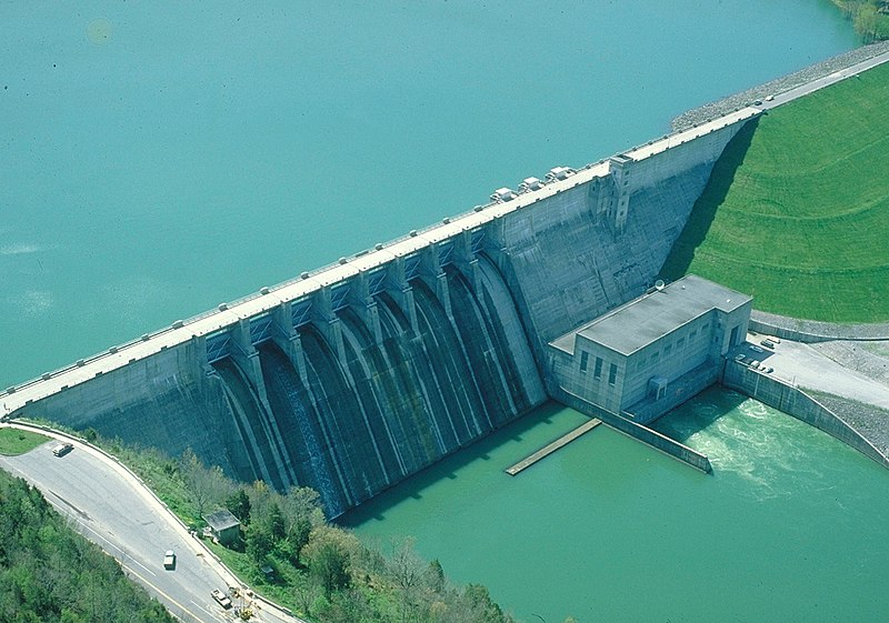
English: Center Hill Dam near Cookeville, Tennessee, USA. The dam impounds Center Hill Lake, 64 miles (103 km) long and covering an area of 18,220 acres (74 km²). The dam provides hydroelectric production and flood control in central Tennessee. |
|||
| Date | ||||
| Source |
U.S. Army Corps of Engineers Digital Visual Library Image page Image description page Digital Visual Library home page |
|||
| Author | George Green, U.S. Army Corps of Engineers | |||
| Permission (Reusing this file) |
|
| Camera location | | View this and other nearby images on: OpenStreetMap |
|---|
File history
Click on a date/time to view the file as it appeared at that time.
| Date/Time | Thumbnail | Dimensions | User | Comment | |
|---|---|---|---|---|---|
| current | 04:55, 31 March 2007 |  | 1,500 × 1,052 (443 KB) | DanMS | {{Information | Description = {{en|Center Hill Dam near Cookeville, Tennessee, USA. The dam impounds Center Hill Lake, 64 miles (103 km) long and covering an area of 18,220 acres (74 km²). The dam provides hydroelectric production and flood control in |
File usage
The following pages on the English Wikipedia use this file (pages on other projects are not listed):
Global file usage
The following other wikis use this file:
- Usage on ceb.wikipedia.org
- Usage on no.wikipedia.org
- Usage on uk.wikipedia.org
- Usage on www.wikidata.org