
File:The site of St. Barnabas' Church, Thornton le Moor - geograph.org.uk - 359237.jpg
No higher resolution available.
The_site_of_St._Barnabas'_Church,_Thornton_le_Moor_-_geograph.org.uk_-_359237.jpg (640 × 480 pixels, file size: 104 KB, MIME type: image/jpeg)
| This is a file from the Wikimedia Commons. Information from its description page there is shown below. Commons is a freely licensed media file repository. You can help. |
Summary
| Description |
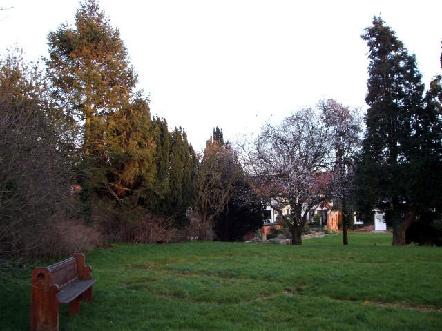
English: The site of St. Barnabas' Church, Thornton le Moor St. Barnabas was built in 1868. In August 1986 part of the East wall collapsed and the church was demolished in April 1987. The churchyard remains as consecrated ground and is still used as the village burial ground. The scar on the ground left by the church walls can be clearly seen. |
| Date | |
| Source | From geograph.org.uk |
| Author | David Cowling |
| Attribution (required by the license) | David Cowling / The site of St. Barnabas' Church, Thornton le Moor / |
| Camera location | | View this and other nearby images on: OpenStreetMap |
|---|
| Object location | | View this and other nearby images on: OpenStreetMap |
|---|
Licensing

|
This image was taken from the Geograph project collection. See this photograph's page on the Geograph website for the photographer's contact details. The copyright on this image is owned by David Cowling and is licensed for reuse under the Creative Commons Attribution-ShareAlike 2.0 license.
|
This file is licensed under the Creative Commons Attribution-Share Alike 2.0 Generic license.
Attribution: David Cowling
- You are free:
- to share – to copy, distribute and transmit the work
- to remix – to adapt the work
- Under the following conditions:
- attribution – You must give appropriate credit, provide a link to the license, and indicate if changes were made. You may do so in any reasonable manner, but not in any way that suggests the licensor endorses you or your use.
- share alike – If you remix, transform, or build upon the material, you must distribute your contributions under the same or compatible license as the original.
File history
Click on a date/time to view the file as it appeared at that time.
| Date/Time | Thumbnail | Dimensions | User | Comment | |
|---|---|---|---|---|---|
| current | 20:10, 2 January 2011 |  | 640 × 480 (104 KB) | GeographBot | == {{int:filedesc}} == {{Information |description={{en|1=The site of St. Barnabas' Church, Thornton le Moor St. Barnabas was built in 1868. In August 1986 part of the East wall collapsed and the church was demolished in April 1987. The churchyard remains |
File usage
The following pages on the English Wikipedia use this file (pages on other projects are not listed):
Global file usage
The following other wikis use this file:
- Usage on ceb.wikipedia.org
- Usage on fr.wikipedia.org
- Usage on lld.wikipedia.org
- Usage on nl.wikipedia.org
- Usage on pl.wikipedia.org
- Usage on www.wikidata.org