
File:St Clair Bridge, 1924.jpg
Original file (2,200 × 1,732 pixels, file size: 596 KB, MIME type: image/jpeg)
| This is a file from the Wikimedia Commons. Information from its description page there is shown below. Commons is a freely licensed media file repository. You can help. |
| This image appeared on Wikipedia's Main Page in the Did you know? column on 14 January 2011 (see archives). |
| Description |
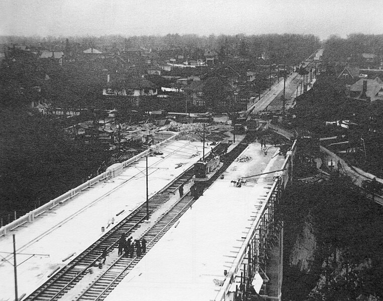
English: Construction of the bridge that carries St Clair Avenue East over David A. Balfour ravine in 1924. View is facing east towards what would later become the Mount Pleasant Extension. Toronto, Ontario, Canada. |
| Date | (UTC) |
| Source | |
| Author |
|
This work is in the public domain in the United States because it meets three requirements:
For background information, see the explanations on Non-U.S. copyrights.
Note: This tag should not be used for sound recordings. |
This Canadian work is in the public domain in Canada because its copyright has expired due to one of the following:
it was not subject to Crown copyright, and
|
 |
Original upload log
This image is a derivative work of the following images:
- File:St_Clair_Bridge,_1924.png licensed with PD-1996, PD-Canada
- 2010-07-26T18:38:53Z Fallschirmjäger 3264x2448 (4402377 Bytes) Converted to true Black & White. Removed thumb from upper left corner, reduced dust and scratches, clean up.
- 2010-07-26T04:18:33Z Floydian 3264x2448 (24012094 Bytes) {{Information |Description=Construction of the bridge that carries St Clair Avenue East over David A. Balfour ravine in 1924. View is facing east towards what would later become the Mount Pleasant Extension |Source=City of To
Uploaded with derivativeFX
File history
Click on a date/time to view the file as it appeared at that time.
| Date/Time | Thumbnail | Dimensions | User | Comment | |
|---|---|---|---|---|---|
| current | 12:10, 14 January 2011 |  | 2,200 × 1,732 (596 KB) | Materialscientist | {{Information |Description={{en|Construction of the bridge that carries St Clair Avenue East over David A. Balfour ravine in 1924. View is facing east towards what would later become the Mount Pleasant Extension. Toronto, Ontario, Canada.}} |Source=*[[:F |