
File:Shanghai highway network.svg

Size of this PNG preview of this SVG file: 496 × 599 pixels. Other resolutions: 199 × 240 pixels | 397 × 480 pixels | 636 × 768 pixels | 848 × 1,024 pixels | 1,696 × 2,048 pixels | 963 × 1,163 pixels.
Original file (SVG file, nominally 963 × 1,163 pixels, file size: 77 KB)
| This is a file from the Wikimedia Commons. Information from its description page there is shown below. Commons is a freely licensed media file repository. You can help. |
Summary
| Description |
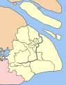
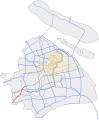
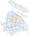
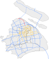
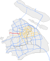
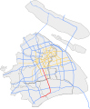
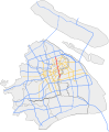
English: A map showing the highway network of Shanghai.
中文:上海公路和高速公路网地图.
|
| Date | |
| Source | Own work |
| Author | Heights |
| Other versions |
This file was derived from: |


Licensing
I, the copyright holder of this work, hereby publish it under the following license:
This file is licensed under the Creative Commons Attribution-Share Alike 3.0 Unported license.
- You are free:
- to share – to copy, distribute and transmit the work
- to remix – to adapt the work
- Under the following conditions:
- attribution – You must give appropriate credit, provide a link to the license, and indicate if changes were made. You may do so in any reasonable manner, but not in any way that suggests the licensor endorses you or your use.
- share alike – If you remix, transform, or build upon the material, you must distribute your contributions under the same or compatible license as the original.
File history
Click on a date/time to view the file as it appeared at that time.
| Date/Time | Thumbnail | Dimensions | User | Comment | |
|---|---|---|---|---|---|
| current | 19:57, 29 December 2020 |  | 963 × 1,163 (77 KB) | Heights | Reverted to version as of 19:54, 29 December 2020 (UTC) |
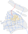
| 19:55, 29 December 2020 |  | 963 × 1,163 (70 KB) | Heights | Reverted to version as of 04:31, 14 November 2017 (UTC) | |
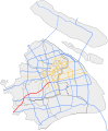
| 19:54, 29 December 2020 |  | 963 × 1,163 (77 KB) | Heights | December 2020 update retry | |
| 19:51, 29 December 2020 | No thumbnail | 963 × 1,163 (1.58 MB) | Heights | December 2020 update | |
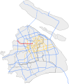
| 04:31, 14 November 2017 |  | 963 × 1,163 (70 KB) | Heights | November 2017 update | |
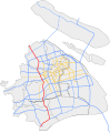
| 00:55, 16 December 2016 |  | 963 × 1,155 (67 KB) | Heights | Reflects new construction as of December 2016. | |
| 16:08, 2 January 2014 |  | 963 × 1,155 (66 KB) | Heights | Hopefully this fixes the border issues, sorry! | |
| 15:56, 2 January 2014 | 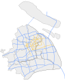 | 949 × 1,200 (66 KB) | Heights | Correct dotted lines | |
| 15:51, 2 January 2014 |  | 949 × 1,200 (66 KB) | Heights | Modified colours; green was too drastic | |
| 02:22, 2 January 2014 |  | 949 × 1,200 (66 KB) | Heights | New map with less clutter Expressways are in green, blue is municipal roadways/elevated roads |
File usage
The following pages on the English Wikipedia use this file (pages on other projects are not listed):
Global file usage
The following other wikis use this file:
- Usage on www.wikidata.org
- Usage on zh.wikipedia.org
- 上海交通
- 沪嘉高速公路
- 京沪高速公路
- 沪蓉高速公路
- 上海高速公路
- 上海迎宾高速公路
- 沪芦高速公路
- 沪奉高速公路
- 莘奉金高速公路
- 嘉金高速公路
- 沪青平高速公路
- 沪宁高速公路
- 沪杭高速公路
- 上海外环高速公路
- 上海绕城高速公路
- 亭枫高速公路
- 新卫高速公路
- 徐浦大桥
- 沪昆高速公路
- 奉浦大桥
- 上海长江隧桥
- 沈海高速公路
- 沪陕高速公路
- 沪渝高速公路
- 杭州湾地区环线高速公路
- 沪崇高速公路
- 沪常高速公路
- 沪翔高速公路
- 嘉金公路黄浦江大桥
- 闵浦大桥
- 申嘉湖高速公路
- 沪金高速公路
- Template:上海市高速公路
- User:Grjgt893u34/后海花半里區
- 沪武高速公路
- 沪杭甬高速公路
- 南奉公路
- 南亭公路
- 宝钱公路
- 宝安公路
- 沪松公路
- 蕰川公路
- 沪太公路
- 陈海公路
- 松卫公路
- 沪南公路
- 浦星公路
- 林海公路
- 朱枫公路
View more global usage of this file.