
File:Sections - Washington Monument, High ground West of Fifteenth Street, Northwest, between Independence and Constitution Avenues, Washington, District of Columbia, DC HABS DC,WASH,2- (sheet 31 of 37).png

Size of this preview: 465 × 600 pixels. Other resolutions: 186 × 240 pixels | 372 × 480 pixels | 595 × 768 pixels | 794 × 1,024 pixels | 1,588 × 2,048 pixels | 13,696 × 17,664 pixels.
Original file (13,696 × 17,664 pixels, file size: 13.14 MB, MIME type: image/png)
| This is a file from the Wikimedia Commons. Information from its description page there is shown below. Commons is a freely licensed media file repository. You can help. |
| This image is a JPEG version of the original TIF image at File: Sections - Washington Monument, High ground West of Fifteenth Street, Northwest, between Independence and Constitution Avenues, Washington, District of Columbia, DC HABS DC,WASH,2- (sheet 31 of 37).tif.
However, any edits to the image should be based on the original TIF version in order to prevent generation loss, and both versions should be updated. Do not make edits based on this version. |
Summary
| Warning | The original file is very high-resolution. It might not load properly or could cause your browser to freeze when opened at full size. |
|---|
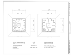
| Sections - Washington Monument, High ground West of Fifteenth Street, Northwest, between Independence and Constitution Avenues, Washington, District of Columbia, DC | ||||
|---|---|---|---|---|
| Photographer |
Arzola, Robert R., creator |
|||
| Title |
Sections - Washington Monument, High ground West of Fifteenth Street, Northwest, between Independence and Constitution Avenues, Washington, District of Columbia, DC |
|||
| Depicted place | District of Columbia; District of Columbia; Washington | |||
| Date | 1994 | |||
| Dimensions | 34 x 44 in. (E size) | |||
| Current location |
Library of Congress Prints and Photographs Division Washington, D.C. 20540 USA http://hdl.loc.gov/loc.pnp/pp.print |
|||
| Accession number |
HABS DC,WASH,2- (sheet 31 of 37) |
|||
| Credit line |
|
|||
| Notes |
|
|||
| References |
Related names:
|
|||
| Source | https://www.loc.gov/pictures/item/dc0261.sheet.00031a | |||
| Permission (Reusing this file) |
|
|||
| Other versions |
                                 |
|||

| Camera location | | View this and other nearby images on: OpenStreetMap |
|---|
File history
Click on a date/time to view the file as it appeared at that time.
| Date/Time | Thumbnail | Dimensions | User | Comment | |
|---|---|---|---|---|---|
| current | 20:00, 11 July 2014 |  | 13,696 × 17,664 (13.14 MB) | Fæ | {{Compressed version|file=File:Sections_-_Washington_Monument,_High_ground_West_of_Fifteenth_Street,_Northwest,_between_Independence_and_Constitution_Avenues,_Washington,_District_of_Columbia,_DC_HABS_DC,WASH,2-_(sheet_31_of_37).tif|thumb=nothumb}} =={... |
File usage
The following pages on the English Wikipedia use this file (pages on other projects are not listed):