
File:Paddington Basin - geograph org uk - 586906 Hilton London Metropole.jpg

No higher resolution available.
Paddington_Basin_-_geograph_org_uk_-_586906_Hilton_London_Metropole.jpg (180 × 148 pixels, file size: 9 KB, MIME type: image/jpeg)
| This is a file from the Wikimedia Commons. Information from its description page there is shown below. Commons is a freely licensed media file repository. You can help. |
| Description |
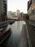
English: Paddington Basin, London, England. Cropped out of File:Paddington Basin - geograph.org.uk - 586906.jpg (see thumb below). More details at Paddington Basin TQ2681 006.. |
| Date | |
| Source |
This file was derived from: Paddington Basin - geograph.org.uk - 586906.jpg |
| Author |
|
| Other versions |
 |
| Camera location | | View this and other nearby images on: OpenStreetMap |
|---|
| Object location | | View this and other nearby images on: OpenStreetMap |
|---|
| This is a retouched picture, which means that it has been digitally altered from its original version. Modifications: cropped. The original can be viewed here: Paddington Basin - geograph.org.uk - 586906.jpg:
|
This file is licensed under the Creative Commons Attribution-Share Alike 2.0 Generic license.
Attribution: Derek Harper
- You are free:
- to share – to copy, distribute and transmit the work
- to remix – to adapt the work
- Under the following conditions:
- attribution – You must give appropriate credit, provide a link to the license, and indicate if changes were made. You may do so in any reasonable manner, but not in any way that suggests the licensor endorses you or your use.
- share alike – If you remix, transform, or build upon the material, you must distribute your contributions under the same or compatible license as the original.
Original upload log
This image is a derivative work of the following images:
- File:Paddington_Basin_-_geograph.org.uk_-_586906.jpg licensed with Cc-by-sa-2.0, Geograph
- 2011-02-06T14:41:05Z GeographBot 473x640 (81435 Bytes) == {{int:filedesc}} == {{Information |description={{en|1=Paddington Basin A boat cuts along the canal basin, seen from a footbridge. St Mary's Hospital is on the right, Waterside House on the left.}} |date=2007-10-13 |source=
Uploaded with derivativeFX
| Annotations | This image is annotated: View the annotations at Commons |
File history
Click on a date/time to view the file as it appeared at that time.
| Date/Time | Thumbnail | Dimensions | User | Comment | |
|---|---|---|---|---|---|
| current | 21:45, 3 March 2011 |  | 180 × 148 (9 KB) | Paravane | {{Information |Description={{en|1=Paddington Basin A boat cuts along the canal basin, seen from a footbridge. St Mary's Hospital is on the right, Waterside House on the left.}} |date=2007-10-13 |Source=*[[:File:Paddington_Basin_-_geograph.org.uk_-_586906. |
File usage
The following pages on the English Wikipedia use this file (pages on other projects are not listed):