
File:POL powiat wileński map.svg

Size of this PNG preview of this SVG file: 691 × 600 pixels. Other resolutions: 277 × 240 pixels | 553 × 480 pixels | 885 × 768 pixels | 1,180 × 1,024 pixels | 2,360 × 2,048 pixels | 750 × 651 pixels.
Original file (SVG file, nominally 750 × 651 pixels, file size: 20 KB)
| This is a file from the Wikimedia Commons. Information from its description page there is shown below. Commons is a freely licensed media file repository. You can help. |
| Description | Położenie powiatu wileńskiego na mapie województwa wileńskiego |
| Date | 12 February 2009 (upload date) |
| Source | Own work |
| Author | Poznaniak |
| Permission (Reusing this file) |
This file is licensed under the Creative Commons Attribution-Share Alike 2.5 Generic license.
|
File history
Click on a date/time to view the file as it appeared at that time.
| Date/Time | Thumbnail | Dimensions | User | Comment | |
|---|---|---|---|---|---|
| current | 19:57, 12 February 2009 | 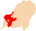 | 750 × 651 (20 KB) | Poznaniak | {{Information |Description=Położenie powiatu wileńskiego na mapie województwa wileńskiego |Source=własna praca |Date=12.02.2009 |Author=Poznaniak |Permission={{cc-by-sa-2.5}} }} [[Category:Locator maps of |
File usage
The following pages on the English Wikipedia use this file (pages on other projects are not listed):
Global file usage
The following other wikis use this file:
- Usage on lt.wikipedia.org
- Usage on pl.wikipedia.org
- Usage on www.wikidata.org