
File:Nevern Square - geograph.org.uk - 1211002.jpg
No higher resolution available.
Nevern_Square_-_geograph.org.uk_-_1211002.jpg (640 × 480 pixels, file size: 131 KB, MIME type: image/jpeg)
| This is a file from the Wikimedia Commons. Information from its description page there is shown below. Commons is a freely licensed media file repository. You can help. |
Summary
| Description |
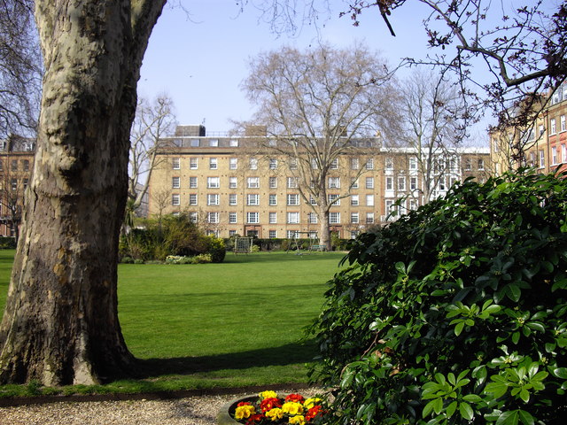
English: Nevern Square Residents of the square formed a company called Nevern Square Garden Limited in 1974 which purchased the garden preventing it from becoming an underground car park serving the Earls Court Exhibition Centre. Over the years they have brought the wasteland at the centre of the square back to life and replaced the metal railings.
The Nevern Square Conservation Area covers Longridge Road, Nevern Road, Nevern Place, Templeton Place, Spear Mews and Trebovir Road with Nevern Square at its centre. |
| Date | |
| Source | From geograph.org.uk |
| Author | PAUL FARMER |
| Attribution (required by the license) | PAUL FARMER / Nevern Square / |
| Camera location | | View this and other nearby images on: OpenStreetMap |
|---|
| Object location | | View this and other nearby images on: OpenStreetMap |
|---|
Licensing

|
This image was taken from the Geograph project collection. See this photograph's page on the Geograph website for the photographer's contact details. The copyright on this image is owned by PAUL FARMER and is licensed for reuse under the Creative Commons Attribution-ShareAlike 2.0 license.
|
This file is licensed under the Creative Commons Attribution-Share Alike 2.0 Generic license.
Attribution: PAUL FARMER
- You are free:
- to share – to copy, distribute and transmit the work
- to remix – to adapt the work
- Under the following conditions:
- attribution – You must give appropriate credit, provide a link to the license, and indicate if changes were made. You may do so in any reasonable manner, but not in any way that suggests the licensor endorses you or your use.
- share alike – If you remix, transform, or build upon the material, you must distribute your contributions under the same or compatible license as the original.
File history
Click on a date/time to view the file as it appeared at that time.
| Date/Time | Thumbnail | Dimensions | User | Comment | |
|---|---|---|---|---|---|
| current | 07:11, 26 February 2011 |  | 640 × 480 (131 KB) | GeographBot | == {{int:filedesc}} == {{Information |description={{en|1=Nevern Square Residents of the square formed a company called Nevern Square Garden Limited in 1974 which purchased the garden preventing it from becoming an underground car park serving the Earls Co |
File usage
The following pages on the English Wikipedia use this file (pages on other projects are not listed):