
File:Mezoregija Trebinje PP.PNG

Size of this preview: 619 × 599 pixels. Other resolutions: 248 × 240 pixels | 496 × 480 pixels | 793 × 768 pixels | 1,057 × 1,024 pixels | 1,809 × 1,752 pixels.
Original file (1,809 × 1,752 pixels, file size: 73 KB, MIME type: image/png)
| This is a file from the Wikimedia Commons. Information from its description page there is shown below. Commons is a freely licensed media file repository. You can help. |
Summary
| Description |
Српски / srpski: Мезорегија Требиње према Просторном плану Републике Српске |
||
| Date | 6 January 2011 (original upload date) | ||
| Source | Transferred from sr.wikipedia; transferred to Commons by User:Micki using CommonsHelper. | ||
| Author | Original uploader was Слободни умјетник at sr.wikipedia | ||
| Permission (Reusing this file) |
CC-BY-SA-3.0-RS; GFDL-NO-DISCLAIMERS. | ||
| Other versions |
|

Licensing
This file is licensed under the Creative Commons Attribution-Share Alike 3.0 Serbia license.
- You are free:
- to share – to copy, distribute and transmit the work
- to remix – to adapt the work
- Under the following conditions:
- attribution – You must give appropriate credit, provide a link to the license, and indicate if changes were made. You may do so in any reasonable manner, but not in any way that suggests the licensor endorses you or your use.
- share alike – If you remix, transform, or build upon the material, you must distribute your contributions under the same or compatible license as the original.


|
Permission is granted to copy, distribute and/or modify this document under the terms of the GNU Free Documentation License, Version 1.2 or any later version published by the Free Software Foundation; with no Invariant Sections, no Front-Cover Texts, and no Back-Cover Texts. A copy of the license is included in the section entitled GNU Free Documentation License. |
Original upload log
The original description page was here. All following user names refer to sr.wikipedia.
- 2011-01-06 12:44 Слободни умјетник 1809×1752× (74956 bytes)
- 2011-01-06 12:42 Слободни умјетник 1809×1752× (75876 bytes) Мезорегија Требиње према Просторном плану Републике Српске
File history
Click on a date/time to view the file as it appeared at that time.
| Date/Time | Thumbnail | Dimensions | User | Comment | |
|---|---|---|---|---|---|
| current | 06:13, 14 August 2011 | 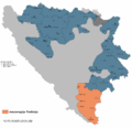 | 1,809 × 1,752 (73 KB) | File Upload Bot (Magnus Manske) | {{BotMoveToCommons|sr.wikipedia|year={{subst:CURRENTYEAR}}|month={{subst:CURRENTMONTHNAME}}|day={{subst:CURRENTDAY}}}} {{Information |Description={{sr|Мезорегија Требиње према Просторном плану Републике Ср� |
File usage
The following pages on the English Wikipedia use this file (pages on other projects are not listed):
Global file usage
The following other wikis use this file:
- Usage on bg.wikipedia.org
- Usage on bs.wikipedia.org
- Usage on ha.wikipedia.org
- Usage on hr.wikipedia.org
- Usage on la.wikipedia.org
- Usage on mk.wikipedia.org
- Usage on ru.wikipedia.org
- Usage on sq.wikipedia.org
- Usage on sr.wikipedia.org
- Usage on uk.wikipedia.org
- Usage on www.wikidata.org