
File:Map Wales Location UK.jpg

No higher resolution available.
Map_Wales_Location_UK.jpg (480 × 430 pixels, file size: 26 KB, MIME type: image/jpeg)
| This is a file from the Wikimedia Commons. Information from its description page there is shown below. Commons is a freely licensed media file repository. You can help. |
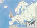
| Description | Location of Wales in UK, on terrain map showing surface and underwater contour areas. | |||
| Date | ||||
| Source | Derived from Wikimedia Commons image of original work forming part of the "Europe location" map series created by David Liuzzo: derived from Image:Europe_location_WAL.png. | |||
| Author | uploaded by User:Wikid77 (excerpt from User:David_Liuzzo) | |||
| Permission (Reusing this file) |
|
|||
| Other versions |
|

File history
Click on a date/time to view the file as it appeared at that time.
| Date/Time | Thumbnail | Dimensions | User | Comment | |
|---|---|---|---|---|---|
| current | 18:30, 5 April 2008 | 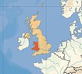 | 480 × 430 (26 KB) | Wikid77 | {{Information |Description=Wales |Source=self-made }}{{PD-self}} |
File usage
The following pages on the English Wikipedia use this file (pages on other projects are not listed):
Global file usage
The following other wikis use this file:
- Usage on pl.wikipedia.org
- Usage on st.wikipedia.org
- Usage on szl.wikipedia.org
- Usage on ta.wikipedia.org