
File:Location map Italy Milan.png

Size of this preview: 642 × 599 pixels. Other resolutions: 257 × 240 pixels | 514 × 480 pixels | 823 × 768 pixels | 1,097 × 1,024 pixels | 2,049 × 1,913 pixels.
Original file (2,049 × 1,913 pixels, file size: 4.33 MB, MIME type: image/png)
| This is a file from the Wikimedia Commons. Information from its description page there is shown below. Commons is a freely licensed media file repository. You can help. |
| Description |
English: Map of Milan
Geographic limits of the map:
This file is licensed under the Creative Commons Attribution-Share Alike 2.0 Generic license.
|
| Source | OpenStreetMap |
| Author | Dr. Blofeld |
File history
Click on a date/time to view the file as it appeared at that time.
| Date/Time | Thumbnail | Dimensions | User | Comment | |
|---|---|---|---|---|---|
| current | 23:41, 9 May 2022 | 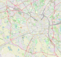 | 2,049 × 1,913 (4.33 MB) | Arbalete | Aggiorno |
| 16:26, 24 April 2014 |  | 2,066 × 1,931 (4.66 MB) | Arbalete | Amplio la mappa per comprendere l'intero territorio comunale. | |
| 10:39, 22 May 2010 |  | 693 × 671 (608 KB) | Dr. Blofeld~commonswiki | {{Information |Description={{en|1=d}} |Source=d |Author=d |Date=d |Permission= |other_versions= }} |
File usage
The following pages on the English Wikipedia use this file (pages on other projects are not listed):
- Affori Centro (Milan Metro)
- Affori FN (Milan Metro)
- Amendola (Milan Metro)
- Bande Nere (Milan Metro)
- Bisceglie (Milan Metro)
- Bollate Centro railway station
- Bonola (Milan Metro)
- Brenta (Milan Metro)
- Bresso Airfield
- Buonarroti (Milan Metro)
- Cadorna (Milan Metro)
- Cairoli (Milan Metro)
- Centrale (Milan Metro)
- Comasina (Milan Metro)
- Conciliazione (Milan Metro)
- Cordusio (Milan Metro)
- Cormano-Cusano Milanino railway station
- Corvetto (Milan Metro)
- Crocetta (Milan Metro)
- De Angeli (Milan Metro)
- Dergano (Milan Metro)
- Duomo (Milan Metro)
- Gambara (Milan Metro)
- Garibaldi FS (Milan Metro)
- Gorla (Milan Metro)
- Inganni (Milan Metro)
- Lampugnano (Milan Metro)
- Lima (Milan Metro)
- Linate Airport
- Lodi T.I.B.B. (Milan Metro)
- Loreto (Milan Metro)
- Lotto (Milan Metro)
- Maciachini (Milan Metro)
- Milano Affori railway station
- Milano Bovisa railway station
- Milano Bruzzano railway station
- Milano Certosa railway station
- Milano Dateo railway station
- Milano Domodossola railway station
- Milano Forlanini railway station
- Milano Greco Pirelli railway station
- Milano Lambrate railway station
- Milano Lancetti railway station
- Milano Porta Genova railway station
- Milano Porta Romana railway station
- Milano Porta Vittoria railway station
- Milano Quarto Oggiaro railway station
- Milano Repubblica railway station
- Milano Rogoredo railway station
- Milano Romolo railway station
- Milano San Cristoforo railway station
- Milano Tibaldi railway station
- Milano Villapizzone railway station
- Missori (Milan Metro)
- Molino Dorino (Milan Metro)
- Montenapoleone (Milan Metro)
- Novate Milanese railway station
- Pagano (Milan Metro)
- Palazzina Appiani
- Parco Sempione
- Pasteur (Milan Metro)
- Pero (Milan Metro)
- Porta Romana (Milan Metro)
- Porta Venezia (Milan Metro)
- Portello (district of Milan)
- Porto di Mare (Milan Metro)
- Precotto (Milan Metro)
- Primaticcio (Milan Metro)
- QT8 (Milan Metro)
- Repubblica (Milan Metro)
- Rho Fiera (Milan Metro)
- Rho Fiera railway station
- Rogoredo (Milan Metro)
- Rovereto (Milan Metro)
- Royal Palace of Milan
- San Babila (Milan Metro)
- San Donato (Milan Metro)
- San Donato Milanese railway station
- San Leonardo (Milan Metro)
- Sesto 1º Maggio (Milan Metro)
- Sesto Marelli (Milan Metro)
- Sesto Rondò (Milan Metro)
- Sondrio (Milan Metro)
- Turati (Milan Metro)
- Turro (Milan Metro)
- Uruguay (Milan Metro)
- Villa San Giovanni (Milan Metro)
- Wagner (Milan Metro)
- Zara (Milan Metro)
- Module:Location map/data/Italy Milan
- Module:Location map/data/Italy Milan/doc
Global file usage
The following other wikis use this file:
- Usage on ar.wikipedia.org
- Usage on az.wikipedia.org
- Usage on bg.wikipedia.org
- Usage on bn.wikipedia.org
- Usage on ca.wikipedia.org
- Usage on ceb.wikipedia.org
- Usage on eo.wikipedia.org
- Katedralo de Milano
- Teatro alla Scala
- Placo Mercanti
- Foiro de Milano
- Ambrozia librejo
- Caiazzo (metroo de Milano)
- Katolika Universitato Sankta Koro (Milano)
- Ŝablono:Informkesto stacio/testoj
- Ŝablono:Situo sur mapo Italio Milano
- Ŝablono:Informkesto stacio/ekzemploj2
- Pinakoteko de Brera
- Milana Konservatorio
- Teatro Dal Verme
- Baziliko de Sankta Bàbila
- Ĉefepiskopujo de Milano
- Universitato de Milano
- Galleria d'Arte Moderna (Milano)
- Milano Centrale (stacidomo)
- Reĝa Palaco de Milano
- Artmuzeo en Piazza della Scala
- Universitato Bocconi
- Politekniko de Milano
- Bosco Verticale
- Baziliko Sankta Ambrozio
- La Casa Astratta
- Usage on es.wikipedia.org
View more global usage of this file.