
File:France 1154-fr.svg
Size of this PNG preview of this SVG file: 503 × 600 pixels. Other resolutions: 201 × 240 pixels | 403 × 480 pixels | 644 × 768 pixels | 859 × 1,024 pixels | 1,718 × 2,048 pixels | 1,405 × 1,675 pixels.
Original file (SVG file, nominally 1,405 × 1,675 pixels, file size: 529 KB)
| This is a file from the Wikimedia Commons. Information from its description page there is shown below. Commons is a freely licensed media file repository. You can help. |
Summary
| Description |
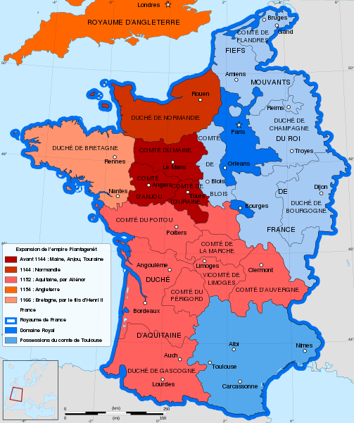
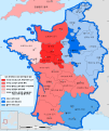
English: French map of the growth of the Plantagenet Empire, from 1144 to 1166.
Français : Carte en français de l'expansion de l'empire Plantagenêt, de 1144 à 1166. |
||
| Date | |||
| Source |
Own work. Sources :
|
||
| Author | Sémhur | ||
| Other versions |
[]
| ||
| Attribution (required by the license) | © Sémhur / Wikimedia Commons / | ||
| SVG | W3C-validity not checked.
|
||
| Atelier graphique |


| Camera location | | View this and other nearby images on: OpenStreetMap |
|---|
Licensing
I, the copyright holder of this work, hereby publish it under the following licenses:
| Copyleft: This work of art is free; you can redistribute it and/or modify it according to terms of the Free Art License. You will find a specimen of this license on the Copyleft Attitude site as well as on other sites. |
This file is licensed under the Creative Commons Attribution-Share Alike 4.0 International, 3.0 Unported, 2.5 Generic, 2.0 Generic and 1.0 Generic license.
- You are free:
- to share – to copy, distribute and transmit the work
- to remix – to adapt the work
- Under the following conditions:
- attribution – You must give appropriate credit, provide a link to the license, and indicate if changes were made. You may do so in any reasonable manner, but not in any way that suggests the licensor endorses you or your use.
- share alike – If you remix, transform, or build upon the material, you must distribute your contributions under the same or compatible license as the original.
You may select the license of your choice.
File history
Click on a date/time to view the file as it appeared at that time.
| Date/Time | Thumbnail | Dimensions | User | Comment | |
|---|---|---|---|---|---|
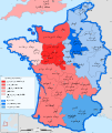
| current | 14:59, 21 May 2021 |  | 1,405 × 1,675 (529 KB) | YaouhPower | Correction orthographe Angoulême |
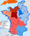
| 11:31, 12 July 2013 |  | 1,405 × 1,675 (542 KB) | Citypeek | Corrected two mistakes in code. Valid SVG now. | |
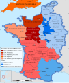
| 08:53, 27 January 2012 |  | 1,405 × 1,675 (542 KB) | Sémhur | Few mistakes in legend | |
| 11:44, 27 July 2009 |  | 1,405 × 1,675 (678 KB) | Sémhur | == {{int:filedesc}} == {{Information |Description= {{en|French map of the growth of the Plantagenet Empire, from 1144 to 1166.}} {{fr|Carte en français de l'expansion de l'empire Plantagenêt, de 1144 à 1166.}} |Source={{own}}. Sources : * [[:Image:Fran |
File usage
The following pages on the English Wikipedia use this file (pages on other projects are not listed):
Global file usage
The following other wikis use this file:
- Usage on be.wikipedia.org
- Usage on es.wikipedia.org
- Usage on eu.wikipedia.org
- Usage on fr.wikipedia.org
- 1154
- Henri II (roi d'Angleterre)
- Comté de Poitou
- Aliénor d'Aquitaine
- Histoire de l'Aquitaine
- Discussion:Cartographie/Archive01
- Comté de Touraine
- Maison de Laval
- Empire Plantagenêt
- Pointe de Grave
- Foulques V d'Anjou
- Duché d'Aquitaine
- Histoire des grandes puissances
- Histoire de l'Anjou
- Comté de Blois
- Discussion:Cartographie
- Discussion:La Rochelle/Archives 1
- Liste des comtesses et duchesses d'Anjou
- Hugues le Brun
- Liste des maîtres de la province d'Auvergne de l'ordre du Temple
- Usage on lt.wikipedia.org
- Usage on pt.wikipedia.org
- Usage on ro.wikipedia.org
- Usage on sk.wikipedia.org
- Usage on sl.wikipedia.org
- Usage on uk.wikipedia.org