
File:European Union South Africa Locator.svg

Size of this PNG preview of this SVG file: 638 × 328 pixels. Other resolutions: 320 × 165 pixels | 640 × 329 pixels | 1,024 × 526 pixels | 1,280 × 658 pixels | 2,560 × 1,316 pixels.
Original file (SVG file, nominally 638 × 328 pixels, file size: 1.69 MB)
| This is a file from the Wikimedia Commons. Information from its description page there is shown below. Commons is a freely licensed media file repository. You can help. |
| Description | |||
| Date | |||
| Source | Own work | ||
| Author | CGN2010 | ||
| Permission (Reusing this file) |
|
File history
Click on a date/time to view the file as it appeared at that time.
| Date/Time | Thumbnail | Dimensions | User | Comment | |
|---|---|---|---|---|---|
| current | 13:42, 26 March 2020 |  | 638 × 328 (1.69 MB) | Hogweard | Update |
| 02:33, 22 July 2014 |  | 638 × 328 (1.47 MB) | Treehill | + south sudan | |
| 10:17, 3 July 2013 | 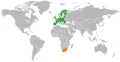 | 638 × 328 (1.47 MB) | Treehill | +croatia | |
| 00:01, 15 May 2010 |  | 940 × 415 (1.52 MB) | CGN2010 | {{Information |Description=European Union - South Africa locator map |Source={{own}} |Date=2010-05-15 |Author={{own}} |Permission={{PD-self}} |other_versions= }} Category:Bilateral maps of the European Union Category:maps of South Africa |
File usage
The following pages on the English Wikipedia use this file (pages on other projects are not listed):
Global file usage
The following other wikis use this file:
- Usage on cs.wikipedia.org
- Usage on fr.wikipedia.org
- Usage on uk.wikipedia.org
- Usage on www.wikidata.org