
File:Church Marsh Nature Reserve in early May - geograph.org.uk - 1285298.jpg
No higher resolution available.
Church_Marsh_Nature_Reserve_in_early_May_-_geograph.org.uk_-_1285298.jpg (640 × 480 pixels, file size: 115 KB, MIME type: image/jpeg)
| This is a file from the Wikimedia Commons. Information from its description page there is shown below. Commons is a freely licensed media file repository. You can help. |
Summary
| Description |
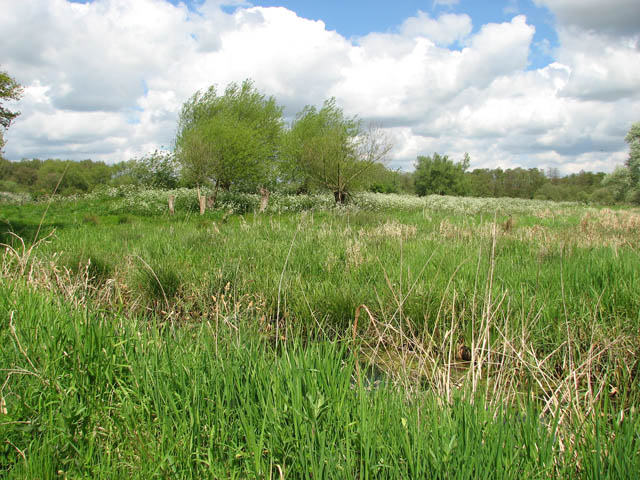
English: Church Marsh Nature Reserve in early May. In spring and summer, marsh harriers, kingfishers, water rails, and reed and sedge warblers can be seen in this small nature reserve which can be accessed via a circular walk which starts and ends by St Mary's church > https://www.geograph.org.uk/photo/1280845. Dogs are only allowed on public footpaths and bridleways. A great variety of wild flowers and plants, some of these rare such as marsh orchids and mild parsley, can be seen and in order to maintain and improve diversity, Highland Cattle is grazed here during the summer months. The site floods in winter, attracting bitterns, gadwalls and shovelers. |
||
| Date | |||
| Source | geograph.org.uk | ||
| Author | Evelyn Simak | ||
| Permission (Reusing this file) |
This file is licensed under the Creative Commons Attribution-Share Alike 2.0 Generic license. Attribution: Evelyn Simak
|
||
| Attribution (required by the license) | Evelyn Simak / Church Marsh Nature Reserve in early May / | ||

| Camera location | | View this and other nearby images on: OpenStreetMap |
|---|
| Object location | | View this and other nearby images on: OpenStreetMap |
|---|
File history
Click on a date/time to view the file as it appeared at that time.
| Date/Time | Thumbnail | Dimensions | User | Comment | |
|---|---|---|---|---|---|
| current | 05:45, 27 February 2011 |  | 640 × 480 (115 KB) | GeographBot | == {{int:filedesc}} == {{Information |description={{en|1=Church Marsh Nature Reserve in early May In spring and summer, marsh harriers, kingfishers, water rails, and reed and sedge warblers can be seen in this small nature reserve which can be accessed vi |
File usage
The following pages on the English Wikipedia use this file (pages on other projects are not listed):