
File:Cesar Topographic 2.png
Size of this preview: 250 × 598 pixels. Other resolutions: 100 × 240 pixels | 200 × 480 pixels | 321 × 768 pixels | 1,025 × 2,453 pixels.
Original file (1,025 × 2,453 pixels, file size: 5.34 MB, MIME type: image/png)
| This is a file from the Wikimedia Commons. Information from its description page there is shown below. Commons is a freely licensed media file repository. You can help. |
Summary
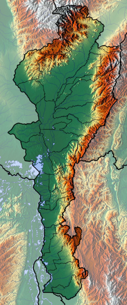
| Description |
Français : Cesar dept |
| Date | |
| Source | Own work (backgroung : http://www.maps-for-free.com) |
| Author | Dr Brains |
Licensing
I, the copyright holder of this work, hereby publish it under the following licenses:

|
Permission is granted to copy, distribute and/or modify this document under the terms of the GNU Free Documentation License, Version 1.2 only as published by the Free Software Foundation; with no Invariant Sections, no Front-Cover Texts, and no Back-Cover Texts. A copy of the license is included in the section entitled GNU Free Documentation License. | 1.2 only |
|
|
Permission is granted to copy, distribute and/or modify this document under the terms of the GNU Free Documentation License, Version 1.3 or any later version published by the Free Software Foundation; with no Invariant Sections, no Front-Cover Texts, and no Back-Cover Texts. A copy of the license is included in the section entitled GNU Free Documentation License.
|
You may select the license of your choice.
File history
Click on a date/time to view the file as it appeared at that time.
| Date/Time | Thumbnail | Dimensions | User | Comment | |
|---|---|---|---|---|---|
| current | 13:29, 9 June 2012 |  | 1,025 × 2,453 (5.34 MB) | Dr Brains |
File usage
The following pages on the English Wikipedia use this file (pages on other projects are not listed):
Global file usage
The following other wikis use this file:
- Usage on avk.wikipedia.org
- Usage on bg.wikipedia.org
- Usage on es.wikipedia.org
- Usage on fa.wikipedia.org
- Usage on fr.wikipedia.org
- Cesar (département colombien)
- Valledupar
- Gamarra
- Agustín Codazzi (municipalité)
- Aguachica
- San Diego (Cesar)
- San Alberto (Cesar)
- La Paz Robles
- Astrea (Cesar)
- Becerril
- Bosconia
- Chimichagua
- Chiriguaná
- Río de Oro (Cesar)
- Pueblo Bello
- Pelaya
- Pailitas
- Curumaní
- El Copey
- La Jagua de Ibirico
- El Paso (Cesar)
- González (Cesar)
- La Gloria (Colombie)
- Modèle:Géolocalisation/Cesar
- Modèle:Géolocalisation/Cesar/Documentation
- Ciénaga de Zapatosa
- Kankuamos
- Usage on he.wikipedia.org
- Usage on nl.wikipedia.org
- Usage on si.wikipedia.org
- Usage on uz.wikipedia.org
- Usage on zh.wikipedia.org