
File:Cambridgeshire - British Isles.svg

Size of this PNG preview of this SVG file: 411 × 599 pixels. Other resolutions: 165 × 240 pixels | 329 × 480 pixels | 527 × 768 pixels | 703 × 1,024 pixels | 1,406 × 2,048 pixels | 1,260 × 1,835 pixels.
Original file (SVG file, nominally 1,260 × 1,835 pixels, file size: 943 KB)
| This is a file from the Wikimedia Commons. Information from its description page there is shown below. Commons is a freely licensed media file repository. You can help. |
| Description | Cambridgeshire location map | ||
| Date | |||
| Source | British Isles in counties.svg | ||
| Author | User:Visitor from Wikishire | ||
| Permission (Reusing this file) |
|
File history
Click on a date/time to view the file as it appeared at that time.
| Date/Time | Thumbnail | Dimensions | User | Comment | |
|---|---|---|---|---|---|
| current | 19:34, 12 September 2019 | 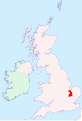 | 1,260 × 1,835 (943 KB) | Hogweard | Colours |
| 22:38, 11 January 2015 |  | 1,250 × 1,835 (933 KB) | Visitor from Wikishire | {{Information |Description=Cambridgeshire location map |Source=British Isles in counties.svg |Date=2014-01-11 |Author=User:Visitor from Wikishire |Permission={{PD-self}} |other_versions= }} [[Category:Maps of... |
File usage
The following pages on the English Wikipedia use this file (pages on other projects are not listed):
Global file usage
The following other wikis use this file:
- Usage on mk.wikipedia.org
- Usage on nl.wikipedia.org