
File:Cam Ranh Bay Landsat elevation image.png
Size of this preview: 800 × 558 pixels. Other resolutions: 320 × 223 pixels | 640 × 446 pixels | 1,017 × 709 pixels.
Original file (1,017 × 709 pixels, file size: 1.2 MB, MIME type: image/png)
| This is a file from the Wikimedia Commons. Information from its description page there is shown below. Commons is a freely licensed media file repository. You can help. |
Summary
| Description |
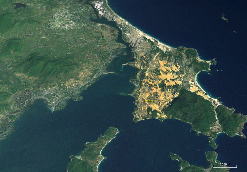
English: Image showing Cam Ranh Bay in Vietnam. Cropped from the image in NASA Worldwind, Landsat image with elevation information. Image height is 15 km. |
| Date | Unknown date of the Landsat data |
| Source | NASA WorldWind java version. Landsat overlay and elevation model. |
| Author | NASA |
Licensing
| This file is in the public domain in the United States because it was solely created by NASA. NASA copyright policy states that "NASA material is not protected by copyright unless noted". (See Template:PD-USGov, NASA copyright policy page or JPL Image Use Policy.) | ||
 |
Warnings:
|
File history
Click on a date/time to view the file as it appeared at that time.
| Date/Time | Thumbnail | Dimensions | User | Comment | |
|---|---|---|---|---|---|
| current | 16:28, 13 March 2016 |  | 1,017 × 709 (1.2 MB) | Oaktree b | User created page with UploadWizard |
File usage
The following pages on the English Wikipedia use this file (pages on other projects are not listed):
Global file usage
The following other wikis use this file:
- Usage on it.wikipedia.org
- Usage on ko.wikipedia.org
- Usage on zh.wikipedia.org