
File:Arcipelaghi italiani.svg

Size of this PNG preview of this SVG file: 477 × 599 pixels. Other resolutions: 191 × 240 pixels | 382 × 480 pixels | 611 × 768 pixels | 815 × 1,024 pixels | 1,630 × 2,048 pixels | 1,034 × 1,299 pixels.
Original file (SVG file, nominally 1,034 × 1,299 pixels, file size: 1.55 MB)
| This is a file from the Wikimedia Commons. Information from its description page there is shown below. Commons is a freely licensed media file repository. You can help. |
Summary
| Description |
Italiano: Mappa di localizzazione dell'Italia con indicazione dei principali arcipelaghi Proiezione equirettangolare, allargamento N/S 132,898 %. Limiti geografici della mappa: * N: 47.4° N * S: 35.3° N * W: 6.2° E * E: 19.0° E |
| Date | (UTC) |
| Source |
This file was derived from: Italy location map.svg:  |
| Author |
|
| Other versions |
|

| This is a retouched picture, which means that it has been digitally altered from its original version. The original can be viewed here: Italy location map.svg:
|
Licensing
I, the copyright holder of this work, hereby publish it under the following licenses:
This file is licensed under the Creative Commons Attribution-Share Alike 3.0 Unported license.
- You are free:
- to share – to copy, distribute and transmit the work
- to remix – to adapt the work
- Under the following conditions:
- attribution – You must give appropriate credit, provide a link to the license, and indicate if changes were made. You may do so in any reasonable manner, but not in any way that suggests the licensor endorses you or your use.
- share alike – If you remix, transform, or build upon the material, you must distribute your contributions under the same or compatible license as the original.

|
Permission is granted to copy, distribute and/or modify this document under the terms of the GNU Free Documentation License, Version 1.2 or any later version published by the Free Software Foundation; with no Invariant Sections, no Front-Cover Texts, and no Back-Cover Texts. A copy of the license is included in the section entitled GNU Free Documentation License. |
You may select the license of your choice.
Original upload log
This image is a derivative work of the following images:
- File:Italy_location_map.svg licensed with Cc-by-sa-3.0, GFDL
- 2010-09-11T06:42:56Z Citypeek 1034x1299 (1484466 Bytes) Made one layer of the entire picture. Better for adding new stuff.
- 2009-08-22T09:58:43Z Erinaceus 1034x1299 (1470342 Bytes) updating borders after important variation (http://www.gazzettaufficiale.it/guridb/dispatcher?service=1&datagu=2009-08-14&task=dettaglio&numgu=188&redaz=009G0127&tmstp=1250276942469)
- 2009-05-06T12:38:21Z NordNordWest 1034x1299 (1035834 Bytes) corr
- 2009-03-12T18:27:05Z NordNordWest 1032x1267 (1032937 Bytes) corr
- 2008-07-06T16:30:54Z NordNordWest 1032x1267 (1034196 Bytes) {{Information |Description= {{de|Positionskarte von [[:de:Italien|Italien]]}} Quadratische Plattkarte, N-S-Streckung 130 %. Geographische Begrenzung der Karte: * N: 47.4° N * S: 35.3° N * W: 6.2° O * O: 19.0° O {{en|Locat
Uploaded with derivativeFX
File history
Click on a date/time to view the file as it appeared at that time.
| Date/Time | Thumbnail | Dimensions | User | Comment | |
|---|---|---|---|---|---|
| current | 12:06, 27 December 2012 | 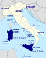 | 1,034 × 1,299 (1.55 MB) | Yiyi | + "Isola di Sicilia" e "Isola di Sardegna" |
| 13:13, 28 October 2012 |  | 1,034 × 1,299 (1.51 MB) | Cwbm (commons) | fixed spalling, Merano -> Marano | |
| 22:04, 10 October 2012 |  | 1,034 × 1,299 (1.55 MB) | Yiyi | + dettagli. | |
| 14:07, 10 October 2012 |  | 1,034 × 1,299 (1.55 MB) | Yiyi | Aggiungo "Arcipelago Spezzino". | |
| 09:47, 10 October 2012 |  | 1,034 × 1,299 (1.55 MB) | Yiyi | Piccole modifiche. | |
| 08:55, 10 October 2012 |  | 1,034 × 1,299 (1.55 MB) | Yiyi | Schiarisco anche "Isole Pelagie". | |
| 08:53, 10 October 2012 |  | 1,034 × 1,299 (1.55 MB) | Yiyi | Aggiungo Isole Borromee e Isole dello Stagnone. Coloro Sicilia e Sardegna e schiarisco scritte e cerchi. | |
| 22:18, 9 October 2012 |  | 1,034 × 1,299 (1.56 MB) | Yiyi | == {{int:filedesc}} == {{Information |Description={{de|Positionskarte von Italien}} Quadratische Plattkarte, N-S-Streckung 132,898 %. Geographische Begrenzung der Karte: * N: 47.4° N * S: 35.3° N * W: 6.2° O * O: 19.0° O {{en|Locat... |
File usage
The following pages on the English Wikipedia use this file (pages on other projects are not listed):
Global file usage
The following other wikis use this file:
- Usage on ca.wikipedia.org
- Usage on cs.wikipedia.org
- Usage on el.wikipedia.org
- Έλβα (νήσος)
- Στρόμπολι
- Αιολίδες νήσοι
- Λίπαρι
- Βουλκάνο
- Σαλίνα
- Αλικούντι
- Μπαζιλούτσο
- Φιλικούντι
- Τζίλιο
- Σαντ Αντίοκο
- Σαν Πιέντρο
- Παντελλερία
- Αζινάρα
- Ίσκια
- Λαμπεντούζα
- Λα Μανταλένα
- Φαβινιάνα
- Μαρέττιμο
- Κάπρι
- Καπρέρα
- Μοντεκρίστο
- Πιανόζα
- Πρότυπο:Νησιά της Ιταλίας
- Ούστικα
- Λεβάντσο
- Λινόζα
- Λαμπιόνε
- Προτσίντα
- Πόντσα
- Καπραΐα
- Τζανούτρι
- Γοργόνα (νησί)
- Παναρέα
- Σπάρτζι
- Ταβολάρα
- Μολάρα
- Αιγάδες Νήσοι
- Πελάγους Νήσοι
- Τοσκανικό αρχιπέλαγος
- Αρχιπέλαγος Λα Μανταλένα
- Αρχιπέλαγος Σούλτσις
- Βιβάρα
- Φλεγραία Νησιά
- Σάντο Στέφανο (Ποντίνε)
- Βεντοτένε
- Usage on fr.wikipedia.org
- Usage on gl.wikipedia.org
View more global usage of this file.