
File:Approaching John Wayne International Airport, Santa Ana, California (6575821593).jpg

Original file (4,000 × 3,000 pixels, file size: 2.68 MB, MIME type: image/jpeg)
| This is a file from the Wikimedia Commons. Information from its description page there is shown below. Commons is a freely licensed media file repository. You can help. |
Summary
| Description |
Santa Ana is the county seat and second most populous city in Orange County, California, and with a population of 324,528 at the 2010 census, Santa Ana is the 57th-most populous city in the United States. Founded in 1869, Santa Ana is located in Southern California adjacent to the Santa Ana River, 10 miles (16 km) away from the California coast. The city is part of the Greater Los Angeles Area which, according to the U.S. Census Bureau, is the second largest metropolitan area in the U.S., with almost eighteen million people. According to the 2000 U.S. Census, of U.S. cities with more than 300,000 people, Santa Ana is the 4th-most densely populated behind only New York City, San Francisco, and Chicago, and slightly denser than Boston. Santa Ana lends its name to the Santa Ana Freeway (I-5), which runs through the city. It also shares its name with the nearby Santa Ana Mountains, and the Santa Ana winds, which have historically fueled seasonal wildfires throughout Southern California. The current Office of Management and Budget (OMB) metropolitan designation for the Orange County Area is "Santa Ana-Anaheim-Irvine, CA". en.wikipedia.org/wiki/Santa_Ana,_California en.wikipedia.org/wiki/Wikipedia:Text_of_Creative_Commons_... |
| Date | |
| Source | Approaching John Wayne International Airport, Santa Ana, California |
| Author | Ken Lund from Reno, Nevada, USA |
| Other versions |
| Camera location | | View this and other nearby images on: OpenStreetMap |
|---|
Licensing
- You are free:
- to share – to copy, distribute and transmit the work
- to remix – to adapt the work
- Under the following conditions:
- attribution – You must give appropriate credit, provide a link to the license, and indicate if changes were made. You may do so in any reasonable manner, but not in any way that suggests the licensor endorses you or your use.
- share alike – If you remix, transform, or build upon the material, you must distribute your contributions under the same or compatible license as the original.
| This image was originally posted to Flickr by Ken Lund at https://flickr.com/photos/75683070@N00/6575821593. It was reviewed on 3 December 2015 by FlickreviewR and was confirmed to be licensed under the terms of the cc-by-sa-2.0. |
File history
Click on a date/time to view the file as it appeared at that time.
| Date/Time | Thumbnail | Dimensions | User | Comment | |
|---|---|---|---|---|---|
| current | 22:15, 3 December 2015 | 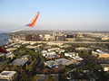 | 4,000 × 3,000 (2.68 MB) | INeverCry | Transferred from Flickr via Flickr2Commons |