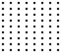
File:Alignement du XXIe siècle.svg

Size of this PNG preview of this SVG file: 688 × 599 pixels. Other resolutions: 276 × 240 pixels | 551 × 480 pixels | 882 × 768 pixels | 1,176 × 1,024 pixels | 2,351 × 2,048 pixels | 2,790 × 2,430 pixels.
Original file (SVG file, nominally 2,790 × 2,430 pixels, file size: 25 KB)
File history
Click on a date/time to view the file as it appeared at that time.
| Date/Time | Thumbnail | Dimensions | User | Comment | |
|---|---|---|---|---|---|
| current | 09:45, 15 June 2009 |  | 2,790 × 2,430 (25 KB) | Herr Satz | {{Information |Description={{en|1=Diagram of ''L'Alignement du XXI{{e}} siècle'' by en:Aurélie Nemours, in en:Rennes.}} {{fr|1=Schéma de ''[[:fr:Alignement du XXIe siècle|L'Alignement du XXI{{e}} siècle] |
File usage
The following pages on the English Wikipedia use this file (pages on other projects are not listed):
Global file usage
The following other wikis use this file:
- Usage on es.wikipedia.org
- Usage on fr.wikipedia.org
- Usage on nl.wikipedia.org
