
File:A2070 from Poundhurst Bridge - geograph.org.uk - 21440.jpg

No higher resolution available.
A2070_from_Poundhurst_Bridge_-_geograph.org.uk_-_21440.jpg (587 × 373 pixels, file size: 39 KB, MIME type: image/jpeg)
| This is a file from the Wikimedia Commons. Information from its description page there is shown below. Commons is a freely licensed media file repository. You can help. |
Summary
| Description |
English: A2070 from Poundhurst Bridge. The bridge from which this picture is taken is in TR0135 but the picture is all TR0035. Who isn't familiar with the sight of a lorry crawling slowly uphill with a long line of cars trailing behind? Here we see the A2070 emerging from Hamstreet Woods on its way to Ashford with the railway hidden behind the trees on the left. This road even has its own website at http://hometown.aol.co.uk/hamcopublishing/a2070.html |
| Date | |
| Source | From geograph.org.uk |
| Author | Adam Colton |
| Attribution (required by the license) | Adam Colton / A2070 from Poundhurst Bridge / |
| Camera location | | View this and other nearby images on: OpenStreetMap |
|---|
| Object location | | View this and other nearby images on: OpenStreetMap |
|---|
Licensing

|
This image was taken from the Geograph project collection. See this photograph's page on the Geograph website for the photographer's contact details. The copyright on this image is owned by Adam Colton and is licensed for reuse under the Creative Commons Attribution-ShareAlike 2.0 license.
|
This file is licensed under the Creative Commons Attribution-Share Alike 2.0 Generic license.
Attribution: Adam Colton
- You are free:
- to share – to copy, distribute and transmit the work
- to remix – to adapt the work
- Under the following conditions:
- attribution – You must give appropriate credit, provide a link to the license, and indicate if changes were made. You may do so in any reasonable manner, but not in any way that suggests the licensor endorses you or your use.
- share alike – If you remix, transform, or build upon the material, you must distribute your contributions under the same or compatible license as the original.
File history
Click on a date/time to view the file as it appeared at that time.
| Date/Time | Thumbnail | Dimensions | User | Comment | |
|---|---|---|---|---|---|
| current | 01:20, 30 January 2010 | 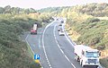 | 587 × 373 (39 KB) | GeographBot | == {{int:filedesc}} == {{Information |description={{en|1=A2070 from Poundhurst Bridge. The bridge from which this picture is taken is in TR0135 but the picture is all TR0035. Who isn't familiar with the sight of a lorry crawling slowly uphill with a long |
File usage
The following pages on the English Wikipedia use this file (pages on other projects are not listed):