
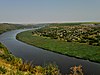
File:Вид от села Ципова - в сторону села Зозуляны - panoramio (cropped).jpg

Size of this preview: 800 × 480 pixels. Other resolutions: 320 × 192 pixels | 1,024 × 615 pixels | 1,280 × 768 pixels | 2,048 × 1,229 pixels.
Original file (2,048 × 1,229 pixels, file size: 728 KB, MIME type: image/jpeg)
| This is a file from the Wikimedia Commons. Information from its description page there is shown below. Commons is a freely licensed media file repository. You can help. |
Summary
| Description | вид от села Ципова - в сторону села Зозуляны |
| Date | Taken on 17 August 2015 |
| Source | https://web.archive.org/web/20161030213950/http://www.panoramio.com/photo/124557209 |
| Author | Анатолий Зубанюк |
| Permission (Reusing this file) |
This file is licensed under the Creative Commons Attribution 3.0 Unported license. Attribution: Анатолий Зубанюк
|
| Other versions |
| Camera location | | View this and other nearby images on: OpenStreetMap |
|---|
File history
Click on a date/time to view the file as it appeared at that time.
| Date/Time | Thumbnail | Dimensions | User | Comment | |
|---|---|---|---|---|---|
| current | 18:37, 3 January 2021 |  | 2,048 × 1,229 (728 KB) | Fourthords | File:Вид от села Ципова - в сторону села Зозуляны - panoramio.jpg cropped 20 % vertically using CropTool with lossless mode. |
File usage
The following pages on the English Wikipedia use this file (pages on other projects are not listed):