
File:Wahlkreise zur Vidhan Sabha von Andhra Pradesh (2014-).svg

Size of this PNG preview of this SVG file: 742 × 600 pixels. Other resolutions: 297 × 240 pixels | 594 × 480 pixels | 951 × 768 pixels | 1,267 × 1,024 pixels | 2,535 × 2,048 pixels | 974 × 787 pixels.
Original file (SVG file, nominally 974 × 787 pixels, file size: 363 KB)
| This is a file from the Wikimedia Commons. Information from its description page there is shown below. Commons is a freely licensed media file repository. You can help. |
Summary
| Description |
Deutsch: Wahlkreise zur Vidhan Sabha von Andhra Pradesh ab dem 2. Juni 2014. English: Vidhan Sabha constituencies in Andhra Pradesh after 2 June 2014. |
| Date | |
| Source |
This file was derived from: Wahlkreise zur Vidhan Sabha von Andhra Pradesh (2008-2014).svg |
| Author | Furfur |
| Permission (Reusing this file) |
This file is licensed under the Creative Commons Attribution-Share Alike 4.0 International license.
|
File history
Click on a date/time to view the file as it appeared at that time.
| Date/Time | Thumbnail | Dimensions | User | Comment | |
|---|---|---|---|---|---|
| current | 17:52, 12 November 2022 | 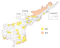 | 974 × 787 (363 KB) | C1MM | Corrected AP/Telangana boundary and expanded constituencies in cities |
| 14:26, 28 May 2019 | 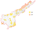 | 1,030 × 850 (509 KB) | Furfur | == {{int:filedesc}} == {{Information |Description={{de|1=Wahlkreise zur Vidhan Sabha von Andhra Pradesh ab dem 2. Juni 2014.}}{{en|1=Vidhan Sabha constituencies in Andhra Pradesh after 2 June 2014.}} |Source={{Derived from|Wahlkreise zur Vidhan Sabha von Andhra Pradesh (2008-2014).svg}} |Date=2019-05-28 |Author=Furfur |Permission={{cc-by-sa-4.0}} |other_versions= }} Category:Assembly constituency maps of Indian States and Union Territories [[Category:SVG maps of Andhra Pra... |
File usage
The following pages on the English Wikipedia use this file (pages on other projects are not listed):
Global file usage
The following other wikis use this file:
- Usage on de.wikipedia.org
- Usage on fr.wikipedia.org
- Usage on hi.wikipedia.org
- Usage on ta.wikipedia.org
- மேற்கு கோதாவரி மாவட்டம்
- கிருஷ்ணா மாவட்டம்
- பிரகாசம் மாவட்டம்
- அனந்தபூர் மாவட்டம்
- சிறீகாகுளம் மாவட்டம்
- பார்வதிபுரம் மண்யம் மாவட்டம்
- அல்லூரி சீதாராம இராஜு மாவட்டம்
- என் டி ஆர் மாவட்டம்
- திருப்பதி மாவட்டம்
- அன்னமய்யா மாவட்டம்
- பயனர்:Pen989/மணல்தொட்டி
- ஆந்திரப் பிரதேச சட்டப் பேரவை தொகுதிகள்
- 2024 ஆந்திரப் பிரதேச சட்டப் பேரவைத் தேர்தல்
- Usage on te.wikipedia.org
- Usage on www.wikidata.org