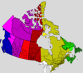
File:UTC hue4map CAN.png
Appearance

Size of this preview: 685 × 599 pixels. Other resolutions: 274 × 240 pixels | 549 × 480 pixels | 878 × 768 pixels | 1,171 × 1,024 pixels | 1,388 × 1,214 pixels.
Original file (1,388 × 1,214 pixels, file size: 135 KB, MIME type: image/png)
File history
Click on a date/time to view the file as it appeared at that time.
| Date/Time | Thumbnail | Dimensions | User | Comment | |
|---|---|---|---|---|---|
| current | 23:31, 8 March 2020 |  | 1,388 × 1,214 (135 KB) | Brycecordry | Updated YT |
| 08:48, 4 November 2018 |  | 1,388 × 1,214 (88 KB) | Heitordp | Updated Northern Rockies | |
| 06:02, 9 August 2018 |  | 1,388 × 1,214 (69 KB) | Joeyconnick | make Newfoundland Time Zone area more visually distinct from Atlantic and year-round Atlantic | |
| 14:10, 28 May 2012 |  | 1,388 × 1,214 (69 KB) | Royaume du Maroc | Remove English text so the image can be used in other Wikipedias too. | |
| 13:42, 28 May 2012 |  | 1,388 × 1,214 (85 KB) | Royaume du Maroc | use colors as in Category:UTC hue4maps, using V=80 for DST | |
| 18:40, 24 November 2011 |  | 1,388 × 1,214 (126 KB) | Phoenix B 1of3 | Eastern Canada | |
| 18:31, 24 November 2011 |  | 1,388 × 1,214 (126 KB) | Phoenix B 1of3 | Central TZ | |
| 18:23, 24 November 2011 |  | 1,388 × 1,214 (126 KB) | Phoenix B 1of3 | Nunavut Fixes | |
| 18:18, 24 November 2011 |  | 1,388 × 1,214 (126 KB) | Phoenix B 1of3 | Changes | |
| 01:49, 4 November 2011 |  | 1,388 × 1,214 (141 KB) | Phoenix B 1of3 | Peace River District |
File usage
The following page uses this file:
Global file usage
The following other wikis use this file:
- Usage on de.wikipedia.org
- Usage on fr.wikipedia.org
- Usage on mni.wikipedia.org
