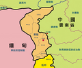
File:Maps of Kokang.png
Appearance

Size of this preview: 719 × 599 pixels. Other resolutions: 288 × 240 pixels | 576 × 480 pixels | 770 × 642 pixels.
Original file (770 × 642 pixels, file size: 169 KB, MIME type: image/png)
File history
Click on a date/time to view the file as it appeared at that time.
| Date/Time | Thumbnail | Dimensions | User | Comment | |
|---|---|---|---|---|---|
| current | 11:45, 25 September 2009 |  | 770 × 642 (169 KB) | Jasonzhuocn | revise |
| 11:34, 25 September 2009 |  | 770 × 642 (165 KB) | Jasonzhuocn | revise | |
| 11:32, 25 September 2009 |  | 770 × 642 (165 KB) | Jasonzhuocn | revise | |
| 11:27, 25 September 2009 |  | 770 × 642 (166 KB) | Jasonzhuocn | revise | |
| 11:24, 25 September 2009 |  | 770 × 642 (166 KB) | Jasonzhuocn | revise | |
| 11:21, 25 September 2009 |  | 770 × 642 (167 KB) | Jasonzhuocn | {{Information |Description={{zh|1=緬甸撣邦第一特區(果敢)}} |Source=Own work by uploader |Author=Jasonzhuocn |Date=2009-09-25 |Permission= |other_versions= }} |
File usage
The following page uses this file:
Global file usage
The following other wikis use this file:
- Usage on ca.wikipedia.org
- Usage on de.wikipedia.org
- Usage on gan.wikipedia.org
- Usage on sat.wikipedia.org
- Usage on www.wikidata.org
- Usage on wuu.wikipedia.org
- Usage on zh-min-nan.wikipedia.org
- Usage on zh-yue.wikipedia.org
- Usage on zh.wikipedia.org

