
File:Karte der Bahnstrecke Uelzen - Braunschweig.png
Size of this preview: 189 × 600 pixels. Other resolutions: 75 × 240 pixels | 591 × 1,876 pixels.
Original file (591 × 1,876 pixels, file size: 406 KB, MIME type: image/png)
| This is a file from the Wikimedia Commons. Information from its description page there is shown below. Commons is a freely licensed media file repository. You can help. |
| Description |
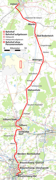
Deutsch: Karte der Bahnstrecke Uelzen - Braunschweig |
| Date | see file history |
| Source |
{own}, using
|
| Author | Maximilian Dörrbecker (Chumwa) |
| Permission (Reusing this file) |
All OpenStreetMap data and maps are Creative Commons "CC-BY-SA 2.0" licensed This file is licensed under the Creative Commons Attribution-Share Alike 2.0 Generic license.
|
| Other versions |
|


File history
Click on a date/time to view the file as it appeared at that time.
| Date/Time | Thumbnail | Dimensions | User | Comment | |
|---|---|---|---|---|---|
| current | 08:44, 6 August 2012 | 591 × 1,876 (406 KB) | Kopiersperre | optipng | |
| 14:54, 2 August 2009 | 591 × 1,876 (617 KB) | Chumwa | {{Information |Description={{de|Karte der Bahnstrecke Uelzen - Braunschweig}} |Author=Maximilian Dörrbecker (Chumwa) |Source={own}, using * OpenStreetMap data for the background * [[:File:Lower_Saxony_location_ |
File usage
The following pages on the English Wikipedia use this file (pages on other projects are not listed):
Global file usage
The following other wikis use this file: