File:JulArcticSfcT.svg
Appearance

Size of this PNG preview of this SVG file: 648 × 600 pixels. Other resolutions: 259 × 240 pixels | 519 × 480 pixels | 830 × 768 pixels | 1,107 × 1,024 pixels | 2,213 × 2,048 pixels | 778 × 720 pixels.
Original file (SVG file, nominally 778 × 720 pixels, file size: 472 KB)
File history
Click on a date/time to view the file as it appeared at that time.
| Date/Time | Thumbnail | Dimensions | User | Comment | |
|---|---|---|---|---|---|
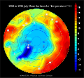
| current | 00:38, 9 September 2007 |  | 778 × 720 (472 KB) | StephenHudson | == Summary == {{Information |Description=This map shows the mean surface air temperature (2 meters above the surface) over the Arctic in July, from NCEP/NCAR Reanalysis data from 1968 to 1996. |Source=Produced at http://www.cdc.noaa.gov/cgi-bin/DataMenus. |
File usage
The following 2 pages use this file:
Global file usage
The following other wikis use this file:
- Usage on az.wikipedia.org
- Usage on fa.wikipedia.org
- Usage on fr.wikipedia.org
- Usage on hy.wikipedia.org
- Usage on id.wikipedia.org
- Usage on nl.wikipedia.org

