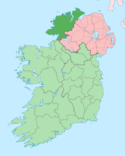
File:Island of Ireland location map Donegal.svg
Appearance

Size of this PNG preview of this SVG file: 481 × 599 pixels. Other resolutions: 192 × 240 pixels | 385 × 480 pixels | 616 × 768 pixels | 822 × 1,024 pixels | 1,643 × 2,048 pixels | 1,450 × 1,807 pixels.
Original file (SVG file, nominally 1,450 × 1,807 pixels, file size: 642 KB)
File history
Click on a date/time to view the file as it appeared at that time.
| Date/Time | Thumbnail | Dimensions | User | Comment | |
|---|---|---|---|---|---|
| current | 13:41, 29 June 2020 |  | 1,450 × 1,807 (642 KB) | Chipmunkdavis | Further edits per the Local Government Reform Act 2014, joining both Tipperarys and both Waterfords (and removing Limerick City code). Colouring in islands, cleaning up and grouping code to remove stray objects and show Galway and Lough Ree. |
| 03:49, 6 May 2016 |  | 1,450 × 1,807 (833 KB) | Houdinipeter | to reflect the changes of the w:Local Government Reform Act 2014 | |
| 00:43, 19 July 2010 |  | 1,450 × 1,807 (815 KB) | Mabuska | {{Information |Description={{en|The island of Ireland, showing international border between Northern Ireland and Republic of Ireland, traditional provinces, traditional counties, and local authority areas in the Republic of Ireland and Northern Ireland.}} |
File usage
More than 100 pages use this file. The following list shows the first 100 pages that use this file only. A full list is available.
- Aghla Beg
- Aghla More
- Annagry
- Ardagh, County Donegal
- Ardara, County Donegal
- Ardloughnabrackbaddy
- Arranmore
- Ballintra
- Ballybofey
- Ballyliffin
- Ballyraine Linear Park
- Ballyshannon
- Barnesmore Gap
- Blue Stack Mountains
- Bunbeg
- Buncrana
- Bundoran
- Burt, County Donegal
- Burtonport
- Carnamoyle
- Carndonagh
- Carrigart
- Castlefin
- Churchill, County Donegal
- Cloghan, County Donegal
- Clonglash
- Clonmany
- Convoy, County Donegal
- County Donegal
- Creeslough
- Derrybeg
- Derryveagh Mountains
- Doe Castle
- Donegal (UK Parliament constituency)
- Donegal (town)
- Donegal Bay
- Downings
- Drumboe Castle
- Dunfanaghy
- Dungloe
- Dunkineely
- Dunlewey
- Dunree
- Fahan
- Falcarragh
- Fanad
- Glashedy
- Glen, County Donegal
- Glen River, County Donegal
- Glencolmcille
- Glenties
- Gola Island
- Gortahork
- Greencastle, County Donegal
- Gweebarra Bay
- Gweedore
- Inishbofin, County Donegal
- Inishowen
- Inishtrahull
- Inver, County Donegal
- Kilcar
- Killea, County Donegal
- Killybegs
- Kilmacrennan
- Kincasslagh
- Kinnagoe Bay
- Laghy
- Leabgarrow
- Letterkenny
- Lifford
- List of Ireland-related topics
- Loch an Iúir
- Lough Derg, County Donegal
- Machaire Rabhartaigh
- Malin, County Donegal
- Manorcunningham
- Milford, County Donegal
- Mountcharles
- Moville
- Muff, County Donegal
- Narin, County Donegal
- Newtown Cunningham
- Pettigo
- Quigley's Point
- R236 road (Ireland)
- Ramelton
- Ranafast
- Raphoe
- Rathmullan
- Rossnowlagh
- Rotten Island
- Rutland Island, County Donegal
- Seven Sisters, Donegal
- Sheephaven Bay
- St Patrick's Purgatory
- Stranorlar
- Teelin
- Termon
- The Rosses
- Tooban
View more links to this file.
Global file usage
The following other wikis use this file:
- Usage on ar.wikipedia.org
- Usage on ast.wikipedia.org
- Usage on bg.wikipedia.org
- Usage on ca.wikipedia.org
- Comtat de Donegal
- Gaoth Dobhair
- Lifford
- Letterkenny
- Plantilla:Comtat Donegal
- Ballyshannon
- Buncrana
- Bundoran
- Ballybofey
- Carndonagh
- Donegal
- Na Rosa
- Cloch Cheann Fhaola
- Gort an Choirce
- An Fál Carrach
- Machaire Rabhartaigh
- Toraigh
- Baile na Finne
- Teileann
- Gleann Cholm Cille
- Carraig Airt
- Na Dúnaibh
- Cill Charthaigh
- Doirí Beaga
- Croithlí
- Oileán na Cruite
- Gabhla
- An Bun Beag
- Anagaire
- Ailt an Chorráin
- An Dúchoraidh
- Cionn Caslach
- Leitir Mhic an Bhaird
- Loch an Iúir
- Rann na Feirste
- An Clochán Liath
- Árainn Mhór
- Rathmullan
- Ramelton
- Milford (Donegal)
- Raphoe
- Inishowen
- Corredor de Donegal
- Killybegs
- Usage on ceb.wikipedia.org
- Usage on cs.wikipedia.org
- Usage on en.wikinews.org
View more global usage of this file.
