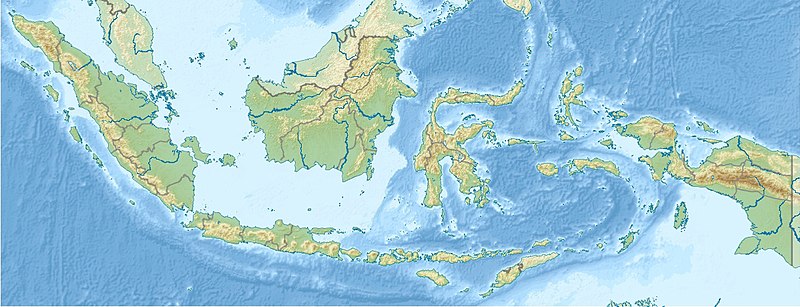
File:Indonesia relief location map.jpg
Appearance

Size of this preview: 800 × 307 pixels. Other resolutions: 320 × 123 pixels | 1,200 × 460 pixels.
Original file (1,200 × 460 pixels, file size: 527 KB, MIME type: image/jpeg)
File history
Click on a date/time to view the file as it appeared at that time.
| Date/Time | Thumbnail | Dimensions | User | Comment | |
|---|---|---|---|---|---|
| current | 18:16, 5 December 2022 | 1,200 × 460 (527 KB) | NordNordWest | upd 2022 | |
| 08:43, 28 June 2013 | 1,200 × 460 (524 KB) | NordNordWest | upd | ||
| 15:33, 21 April 2010 | 1,200 × 460 (474 KB) | Uwe Dedering | {{Information |Description={{en|1=Location map of Indonesia. Equirectangular projection. Strechted by 100.0%. Geographic limits of the map: * N: 6.5° N * S: -11.5° N * W: 94.5° E * E: 141.5° E Made with Natural Earth. Free vector and raster map |
File usage
More than 100 pages use this file. The following list shows the first 100 pages that use this file only. A full list is available.
- 1938 Banda Sea earthquake
- 2005 Nias–Simeulue earthquake
- 2006 Pangandaran earthquake and tsunami
- Anak Krakatoa
- Archipelago
- Banda Api
- Banua Wuhu
- Barito River
- Bird's Head Peninsula
- Bromo Tengger Semeru National Park
- Ciliwung
- Dieng Volcanic Complex
- Digul
- Dukono
- Flores Sea
- Gamalama
- Geography of Indonesia
- Gunung Karang
- HMAS Ipswich (J186)
- Halmahera Sea
- Hulubelu
- Iliwerung
- Indonesia Open (golf)
- Indonesian archipelago
- Istiqlal Mosque, Jakarta
- Iyang-Argapura
- Java Sea
- Kamojang
- Karaha Crater
- Keriau River
- Kiaraberes-Gagak
- Krakatoa
- Lake Matano
- Lake Poso
- Lake Ranau
- Lake Singkarak
- Lake Toba
- Lake Towuti
- Lawa River (Indonesia)
- Leuser Range
- Lombok Strait
- Madura Strait
- Makassar Strait
- Malang Plain
- March 2007 Sumatra earthquakes
- Meru Betiri National Park
- Molucca Sea
- Motorola International Bintan
- Mount Awu
- Mount Batutara
- Mount Binaiya
- Mount Bromo
- Mount Dempo
- Mount Gamkonora
- Mount Gede
- Mount Gede Pangrango National Park
- Mount Guntur
- Mount Hiri
- Mount Ibu
- Mount Ile Lewotolok
- Mount Kawi
- Mount Kendang
- Mount Kerinci
- Mount Klabat
- Mount Lamongan
- Mount Lawu
- Mount Lurus
- Mount Malabar
- Mount Marapi
- Mount Merbabu
- Mount Muria
- Mount Penanggungan
- Mount Perbakti
- Mount Sindoro
- Mount Talakmau
- Mount Talang
- Mount Tambora
- Mount Tampomas
- Mount Tarakan
- Mount Telomoyo
- Mount Tidar
- Mount Ungaran
- Mount Wilis
- Mount Wurlali
- Musi River (Indonesia)
- Old Banten
- Pulosari (volcano)
- Puncak Trikora
- Sangeang Api
- Sangiran
- Semeru
- Seram Sea
- Solo Man
- Subak (irrigation)
- Sukhoi Superjet 100
- Sunda Strait
- Talagabodas
- Tangguh gas field
- Trinil
- Tropical Rainforest Heritage of Sumatra
View more links to this file.
Global file usage
The following other wikis use this file:
- Usage on als.wikipedia.org
- Usage on ar.wikipedia.org
- Usage on ast.wikipedia.org
- Usage on az.wikipedia.org
- Sulavesi
- Yeni Qvineya
- Sumatra
- Kelimutu
- Yava dənizi
- Makassar boğazı
- Şablon:Yer xəritəsi İndoneziya
- Yava
- Karimata boğazı
- Sinqapur boğazı
- Zond (Sunda) boğazı
- Alas boğazı
- Alor boğazı
- Lombok boğazı
- Badunq boğazı
- Bali boğazı
- Madura boğazı
- Malakka boğazı
- Raja Ampat adaları
- Misool
- Salavati
- Batanta
- Vayqeo
- Manipa boğazı
- Timor
- Malay arxipelaqı
- Halmahera (ada)
- Kalimantan
- Yos-Sudarso
- Raunq
- Banqka
- Buru
- Sumbava
- Sumba
- Flores (ada)
- Seram (ada)
- Lombok
- Bali
- Krakatau vulkanı
- Ambon
- Ternate
View more global usage of this file.

