
File:Bihar.India.png

No higher resolution available.
Bihar.India.png (768 × 542 pixels, file size: 42 KB, MIME type: image/png)
| This is a file from the Wikimedia Commons. Information from its description page there is shown below. Commons is a freely licensed media file repository. You can help. |
Summary
| Description |
English: This image is wrong because arunachal pradesh is mein with light blue while others states are of blue coloured. Light blue coloured area is it of india and AH is not ut of India it is state. |
| Source | |
| Author |
Licensing

|
Permission is granted to copy, distribute and/or modify this document under the terms of the GNU Free Documentation License, Version 1.2 or any later version published by the Free Software Foundation; with no Invariant Sections, no Front-Cover Texts, and no Back-Cover Texts. A copy of the license is included in the section entitled GNU Free Documentation License. |
This file is licensed under the Creative Commons Attribution-Share Alike 3.0 Unported license.
- You are free:
- to share – to copy, distribute and transmit the work
- to remix – to adapt the work
- Under the following conditions:
- attribution – You must give appropriate credit, provide a link to the license, and indicate if changes were made. You may do so in any reasonable manner, but not in any way that suggests the licensor endorses you or your use.
- share alike – If you remix, transform, or build upon the material, you must distribute your contributions under the same or compatible license as the original.
Original upload log
The original description page was here. All following user names refer to en.wikipedia.
- 2011-02-23 10:24 Maverick.Mohit 768×542× (42801 bytes) {{Information |Description = I have created this picture after editing two pictures available in commons. |Source = http://en.wikipedia.org/wiki/File:Bihar_locator_map.svg and http://en.wikipedia.org/wiki/File:India_kerala.png |Date
File history
Click on a date/time to view the file as it appeared at that time.
| Date/Time | Thumbnail | Dimensions | User | Comment | |
|---|---|---|---|---|---|
| current | 19:02, 9 July 2011 | 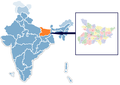 | 768 × 542 (42 KB) | MGA73bot2 | {{BotMoveToCommons|en.wikipedia|year={{subst:CURRENTYEAR}}|month={{subst:CURRENTMONTHNAME}}|day={{subst:CURRENTDAY}}}} {{Information |Description={{en|I have created this picture in MS paint after editing two pictures available in commons.}} |Source=Tra |
File usage
The following page uses this file: