
File:Biak-na-BatoNationalParkjf6143 06.JPG

Size of this preview: 450 × 600 pixels. Other resolutions: 180 × 240 pixels | 360 × 480 pixels | 576 × 768 pixels | 768 × 1,024 pixels | 1,536 × 2,048 pixels | 3,456 × 4,608 pixels.
Original file (3,456 × 4,608 pixels, file size: 1.54 MB, MIME type: image/jpeg)
| This is a file from the Wikimedia Commons. Information from its description page there is shown below. Commons is a freely licensed media file repository. You can help. |
Summary
| Description |
English: Hanging Bridge I, Boulders, Natural forest-hiking trails, Forest trees, Creek and River (Biak-na-Bato National Park, San Miguel, Bulacan), Welcome Arch-Road signs-Monuments-Caves and Trails Maps (Biak-na-Bato National Park, Biak-na-Bato, San Miguel, Bulacan),
Emilio Aguinaldo Mural Shrine (Biak-na-Bato National Park, San Miguel, Bulacan) in Barangay Biak-na-Bato, Zone 2-3, beside Sibul Springs and Pacalag, San Miguel, Bulacan; Welcome Arch and Welcome Monuments of Biak-na-Bato National Park, 1897 Republic of Biak-na-Bato Constitution, and the December27, 1897 Biak-na-Bato Pact or Treaty of Peace Pact of Biak-na-Bato signed on December 14, 1897 First Philippine Republic, Protected areas IUCN category V (protected landscape seascape), Forest, Watershed and Mining Resrvations, including the attractions of Breast-shaped hill, Mount Susong Dalaga, Mount Nablo, Balaong River, and Tilandong Falls, Yungib Caes I, II and III, Tanggapan Cave, Cuarto-Cuarto Cave, Aguinaldo Cave, Carlos, Boy and Lito, Kambal, Suklib, Siniluan, Sapang Kuweba, Santol, Ambush, Kambing, Balubad, Isko, Maningning,Bahay Paniki, Pahingahan Caves, Grotto, Hiking trails, Sitio Lawa, inside the 658.8497 hectares National Park under the jurisdiction and located in both Towns of Doña Remedios Trinidad, Bulacan and San Miguel, Bulacan along the Sibul Springs-BiaknaBato, San Miguel, Bulacan Farm to Market Road interconnecting with and from the Salangan-Santa Rita Bata-Santa Rita Matanda-San Juan-Tibagan-Pulong Bayabas-Pacalag, San Miguel-Buhol na Mangga, San Ildefonso, Bulacan National Road (accessed along and from the Maharlika Highway (Cagayan Valley Road, San Miguel, Bulacan section) of the Pan-Philippine Highway, also known as the Maharlika "Nobility/freeman" Highway or Asian Highway 26, Cagayan Valley Road). |
| Date | |
| Source | Self-photographed |
| Author | Ramon FVelasquez |
Licensing
Photograph
I, the copyright holder of this work, hereby publish it under the following license:
This file is licensed under the Creative Commons Attribution-Share Alike 3.0 Unported license.
- You are free:
- to share – to copy, distribute and transmit the work
- to remix – to adapt the work
- Under the following conditions:
- attribution – You must give appropriate credit, provide a link to the license, and indicate if changes were made. You may do so in any reasonable manner, but not in any way that suggests the licensor endorses you or your use.
- share alike – If you remix, transform, or build upon the material, you must distribute your contributions under the same or compatible license as the original.
Commemorative plaque
| The work depicted in this photograph or illustration is in the public domain in the Philippines and possibly other jurisdictions because it is a work created by an officer or employee of the Government of the Philippines or any of its subdivisions and instrumentalities, including government-owned and/or controlled corporations, as part of his regularly prescribed official duties; and consequently any work is ineligible for copyright under the terms of Part IV, Chapter I, Section 171.11 and Part IV, Chapter IV, Section 176 of Republic Act No. 8293 and Republic Act No. 10372, as amended, unless otherwise noted. However, in some instances, the use of this work in the Philippines or elsewhere may be regulated by this law or other laws. | 
|
File history
Click on a date/time to view the file as it appeared at that time.
| Date/Time | Thumbnail | Dimensions | User | Comment | |
|---|---|---|---|---|---|
| current | 23:32, 9 February 2013 | 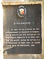 | 3,456 × 4,608 (1.54 MB) | Wtmitchell | Rotated the image 90 degrees clockwise. |
| 08:17, 9 February 2013 |  | 4,608 × 3,456 (6.42 MB) | Ramon FVelasquez | User created page with UploadWizard |
File usage
The following pages on the English Wikipedia use this file (pages on other projects are not listed):
Global file usage
The following other wikis use this file:
- Usage on tl.wikipedia.org