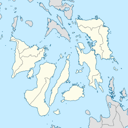
Caubian Islands
Mga isla sa Caubian | |
|---|---|
 Caubian Gamay Island | |
| Geography | |
| Coordinates | 10°16′38″N 124°10′8″E / 10.27722°N 124.16889°E |
| Archipelago | Philippine |
| Adjacent to | Camotes Sea |
| Administration | |
| Region | Central Visayas |
| City | Lapu-Lapu |
| Barangay | Caubian |
| Demographics | |
| Population | 2,429 (2020) |
| Ethnic groups | Cebuano |
Caubian Islands is a group of islands of Lapu-Lapu City, Philippines. Located in the Camotes Sea, it is approximately 13 kilometers (8.1 mi) north from Getafe, Bohol, and 15 kilometers (9.3 mi) east from Mactan Island. The islands comprise of two small islands: the bigger uninhabited Caubian Daku, also called Poo, and the smaller but densely populated Caubian Gamay. Both islands are located in the Danajon Bank, the only double barrier reef in the Philippines and known to be one of the richest fishing grounds in the country. It is part of the Olango Island Group. Most of the families depend on fishing and speak the Cebuano language. According to the 2020 census, the islands has a population of 2,429.[1] With an area of around 0.06km2, Caubian Gamay has an estimated population density of 60,725/km2. It is regarded to be one of the densest populated islands in the world.

Facilities[edit]
Currently, the islands has an elementary school and a basketball court. Grade 7 to 12 students have to travel to the nearest high school in Olango Island. As of 2021, the barangay has no permanent barangay hall, daycare center and health center. The local officials are temporarily using a facility owned by a foundation where they do meetings and attend to their constituents.[2] The barangay can be reached by motorized bangka through Angasil Port in Mactan or Sta. Rosa Port in Olango.
Natural Hazards[edit]
Caubian is exposed to hazards such as strong typhoons and sea level rise, which is believed to be caused by climate change.[3] On December 16, 2021, the residents of Caubian were evacuated to Mactan before the arrival of the Category 5 tropical cyclone, Typhoon Rai, or known in the Philippines as Super Typhoon Odette. [4] In its aftermath, a number of houses and infrastructure were damaged and affected families were given immediate relief aid by the local government and non-government organizations.[5] The residents of the islands get their portable water supply from Mactan and Olango, transporting to the islands by boat. With the El Niño forecasted to intensity starting in October, 2023, the Disaster Risk Reduction and Management Office of the city of Lapu-Lapu City is monitoring that people in Caubian can still have access to fresh water.[6]
See also[edit]
References[edit]
- ^ "Barangay Caubian - Philippine Standard Geographic Code". Philippine Statistics Authority. Retrieved 2022-06-30.
- ^ "Acting Barangay Chief: Barangay hall, daycare, health center for Caubian". Cebu Daily News. Retrieved 2021-08-02.
- ^ "Lapu-Lapu City to evacuate residents of 'submerged' Island". Philippine News Agency. Retrieved 2021-10-11.
- ^ "Nearly 4K Lapu-Lapu City villagers evacuate due to 'Odette'". Philippine News Agency. Retrieved 2021-12-16.
- ^ "Lapu-Lapu starts distribution of P5K aid to Odette-affected families". Cebu Daily News. Retrieved 2022-01-17.
- ^ Inso, Futch Anthony. "Lapu-Lapu Disaster Risk Reduction body: P78M fund ready for el Niño". Cebu Daily News. Retrieved May 22, 2023.
External links[edit]
- "I-Witness: Makalipas ang 15 taon, ano na ang nagbago sa Caubian Island?". GMA Network. Retrieved 29 November 2019.
- Caubian Island- 4k, Lapulapu City (c) Peter Lua Dy (hosted on YouTube.com)


